This was one of the most gruelling hikes for us – Mo & family and me. We talked about a hike a few days before. I brought a brochure of hikes in the Crowsnest Pass for Mo & family to look at. Since S really wanted a hike during one of our last year’s camping trips, I suggested that she pick the spot. She picked the North York Creek plane crash hike. It’s south of Coleman, AB. I asked if anybody mined that I drove because my stomach had been iffy – motion sickness often gets to me. So we all piled into my van and went. We stopped at Subway for a bite before heading up. The weather was decidedly cool when we got out – a balmy 16°C. We were wondering if it would be chilly and rainy all day.
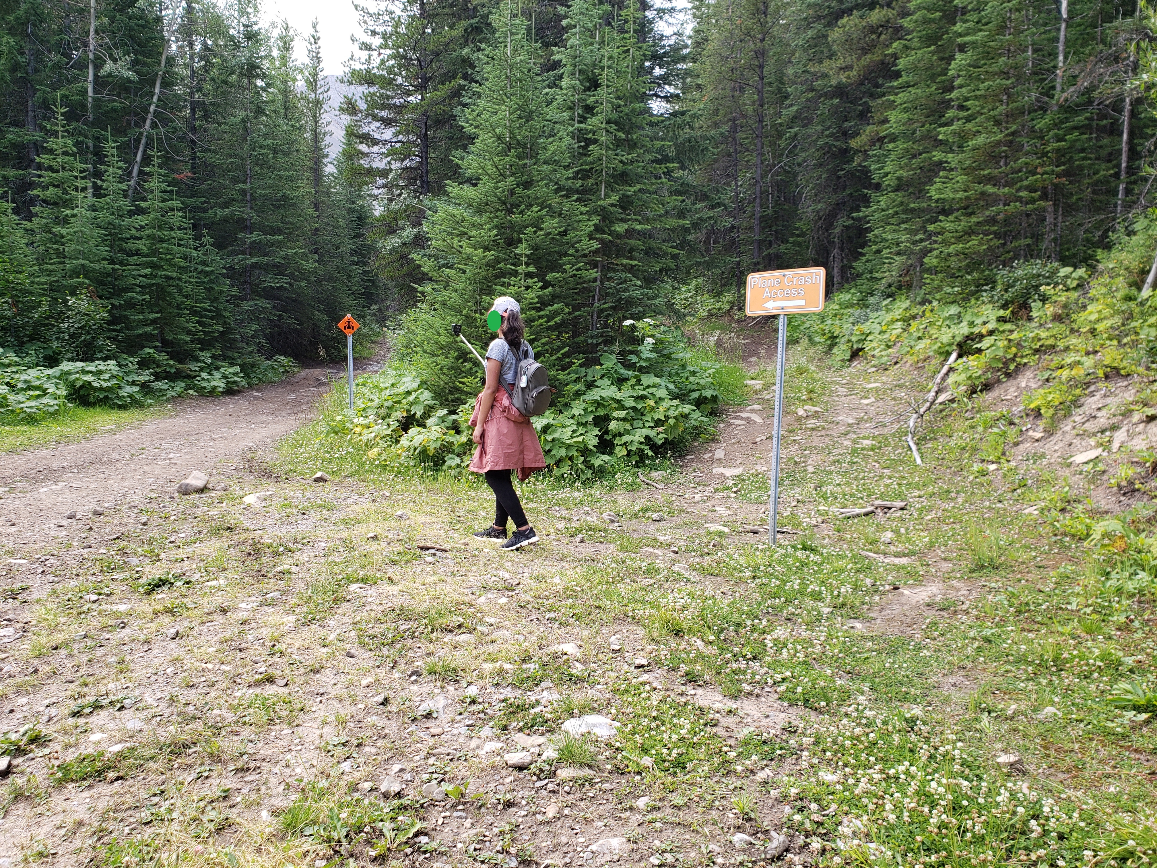
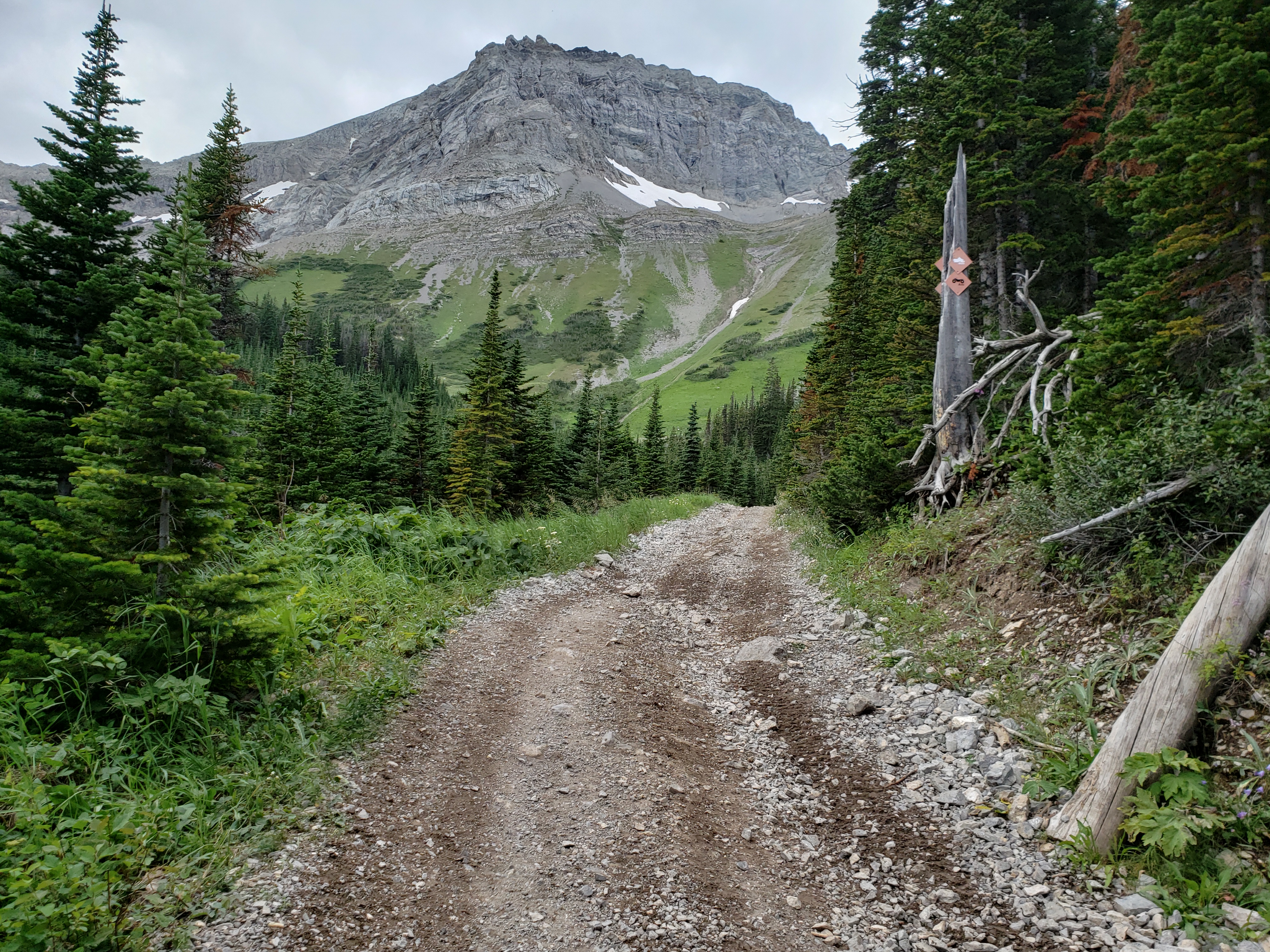
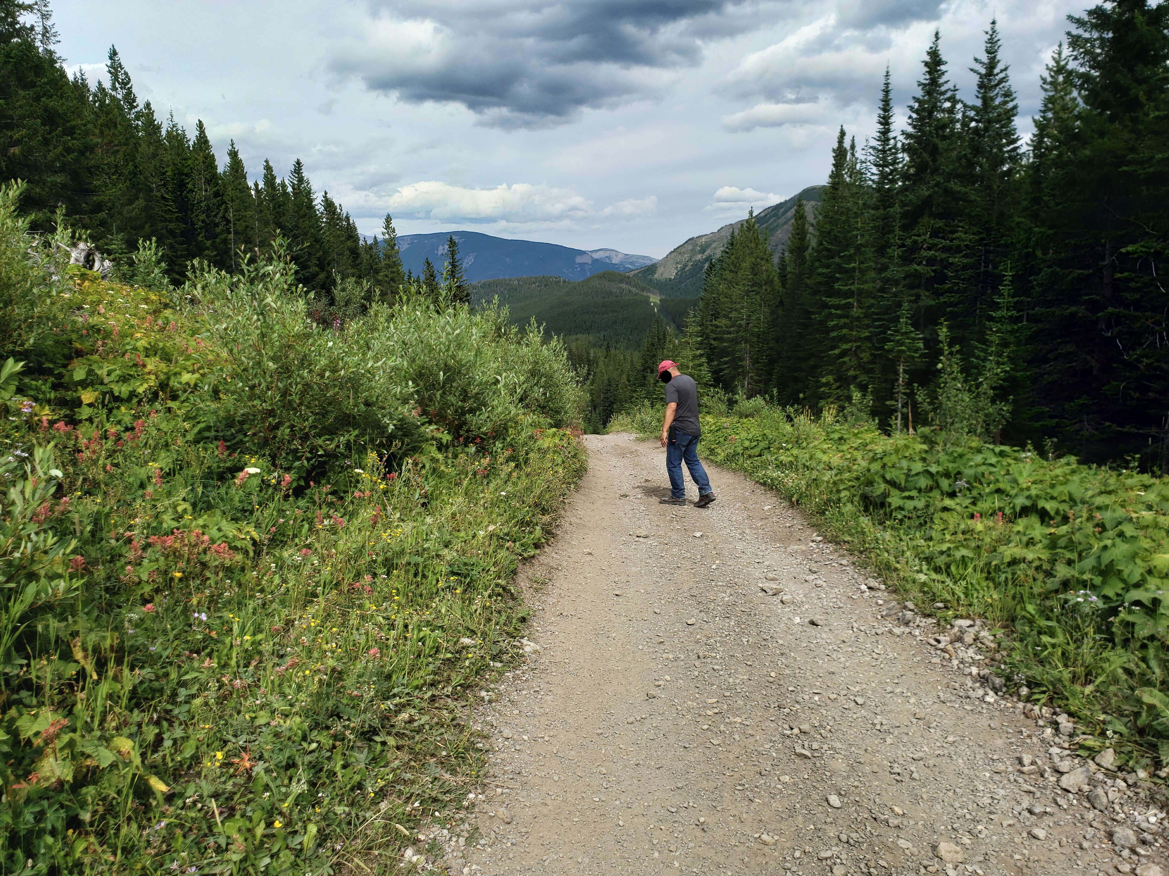
We drove seemingly in every direction, winding through the town, before finally heading south up a paved then gravel road, higher and higher up the mountain. We saw signs for our destination. We found a parking area (called a staging area – not sure why), parked there, and ate half our subs before heading up the gravel road toward our destination. Quads and dirt bikes screamed by. We wondered if we were in the right area – after all, M & M have kids. I asked a guy sitting in his truck if we were in the right spot; he suggested that we were way off, that we needed to keep going way up the road another few kilometres. So we did.
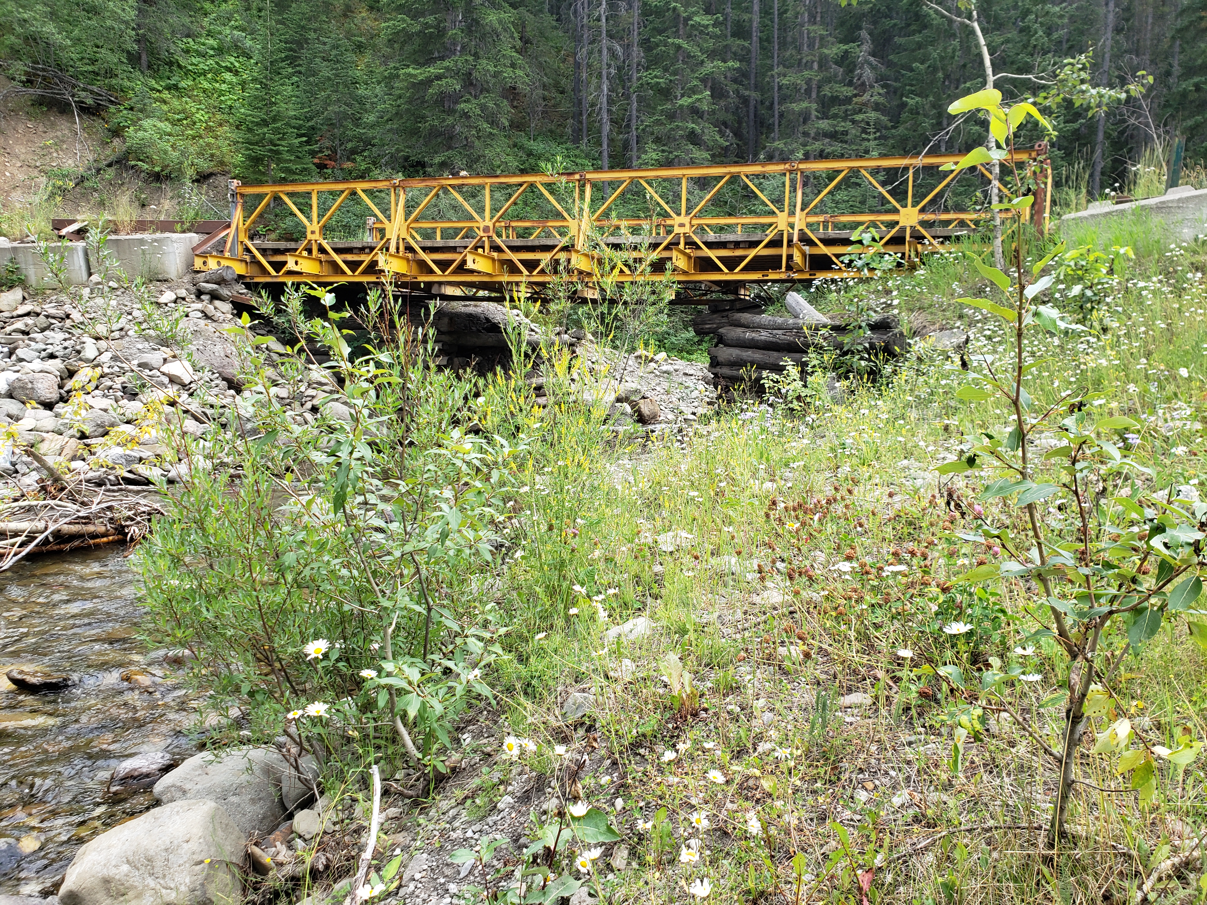
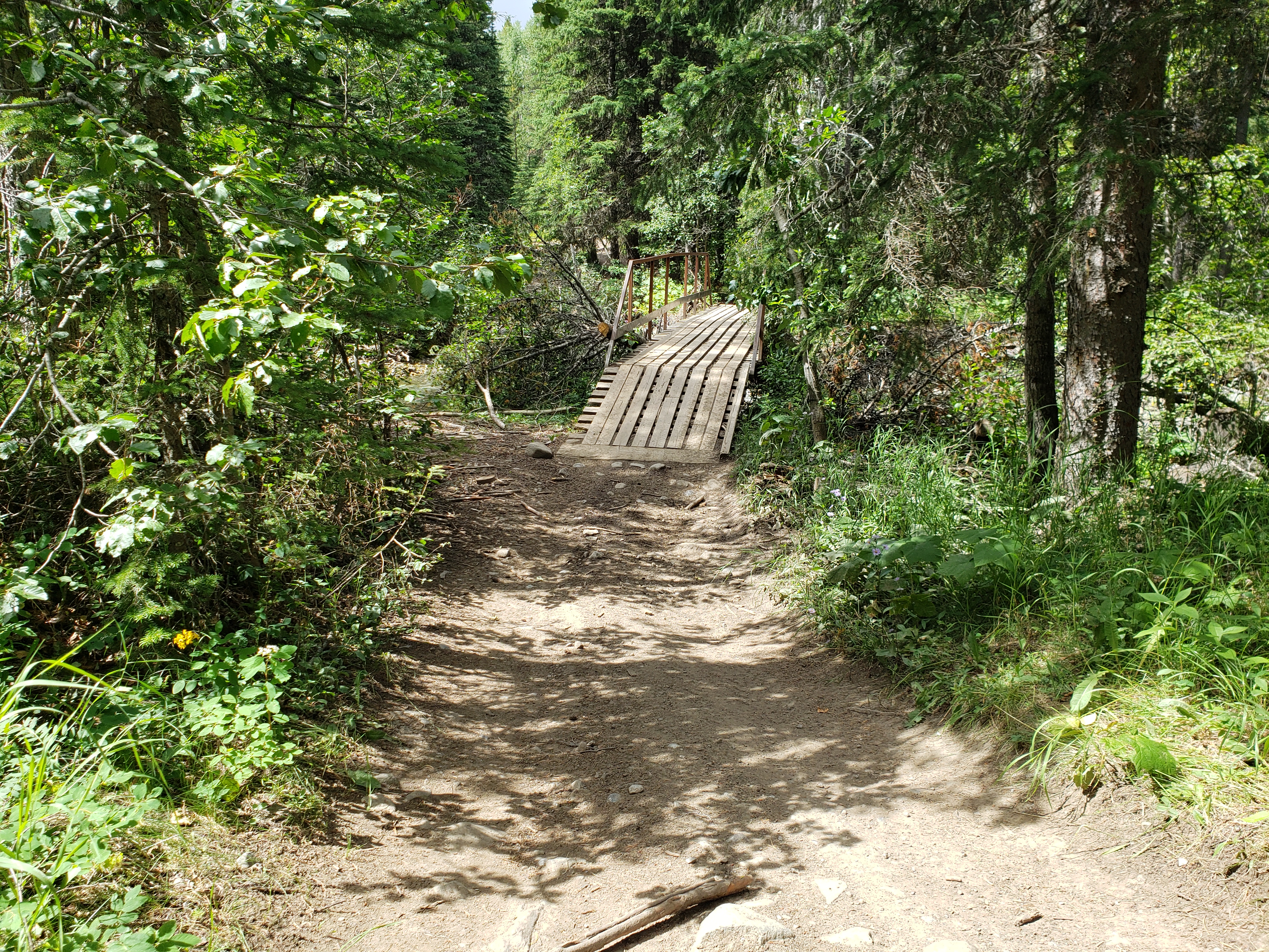
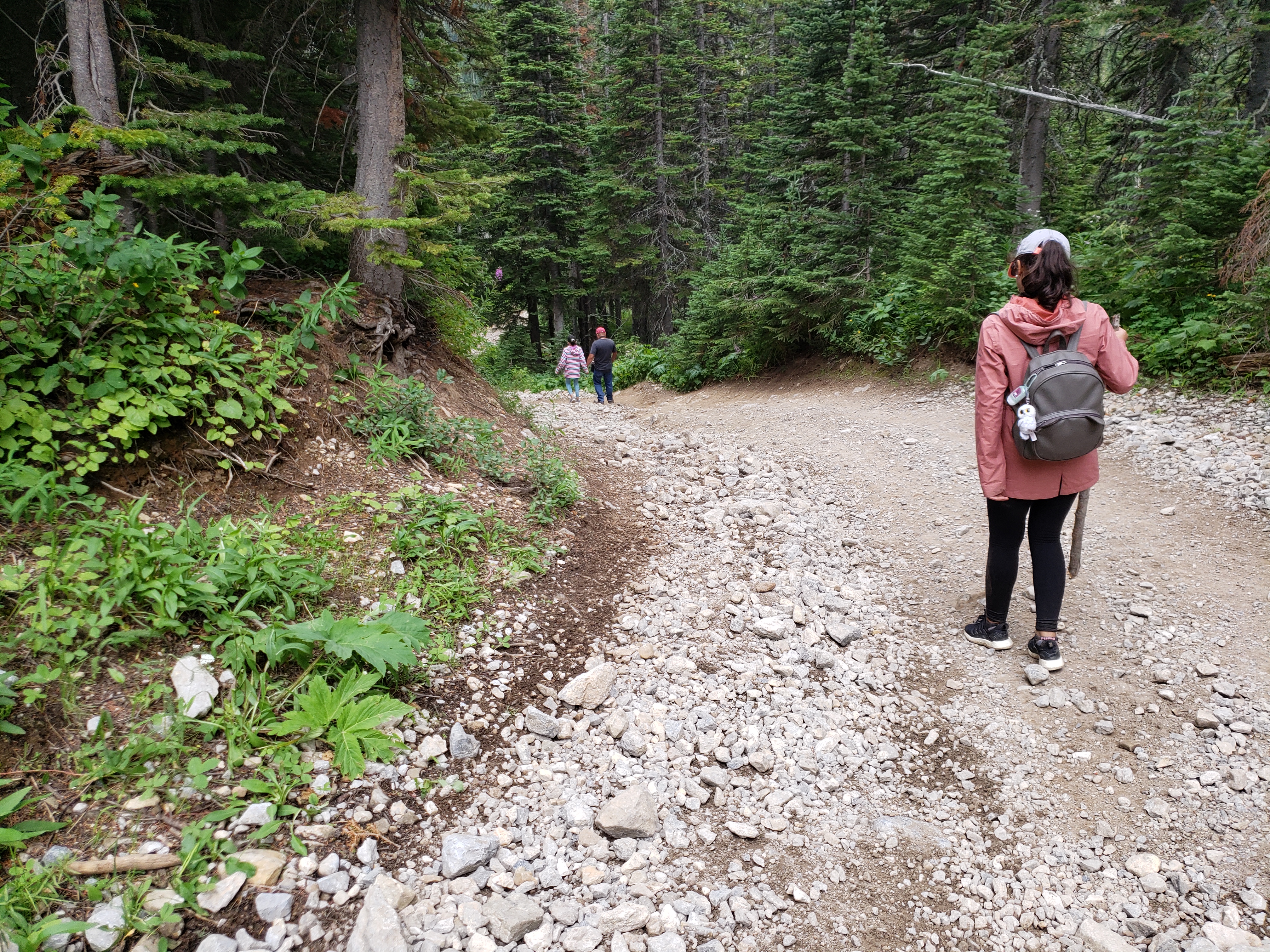
Mo was a little freaked by all the potholes, concerned that it would damage the van. It was rough, and we bounced around like a bunch of Mexican jumping beans in the van. So we parked the van and started hiking. More vehicles were going by. It was still a long hike up, but we came across a bridge (that everyone told us about) and a fork and decided to go up the steeper grade.
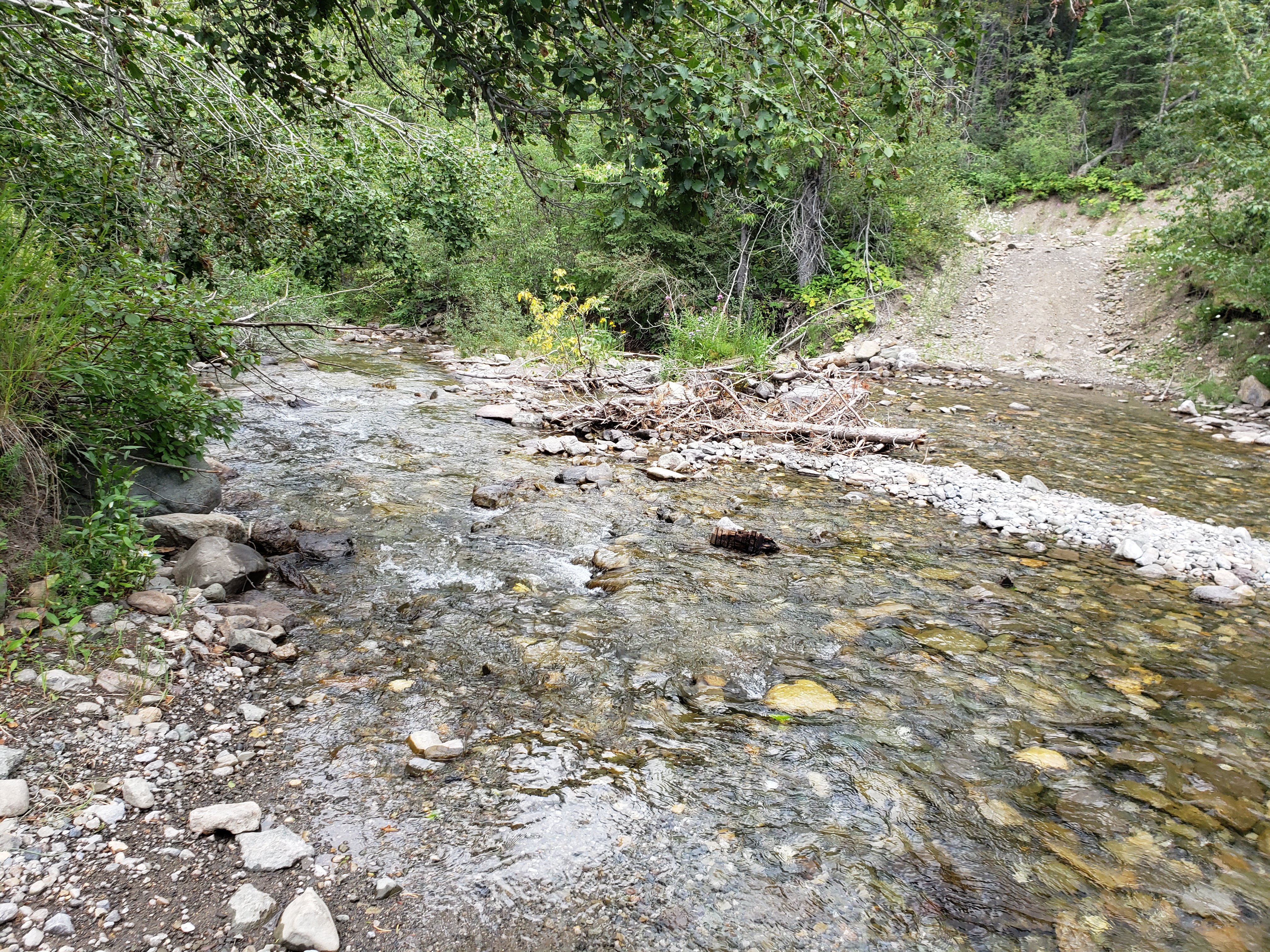
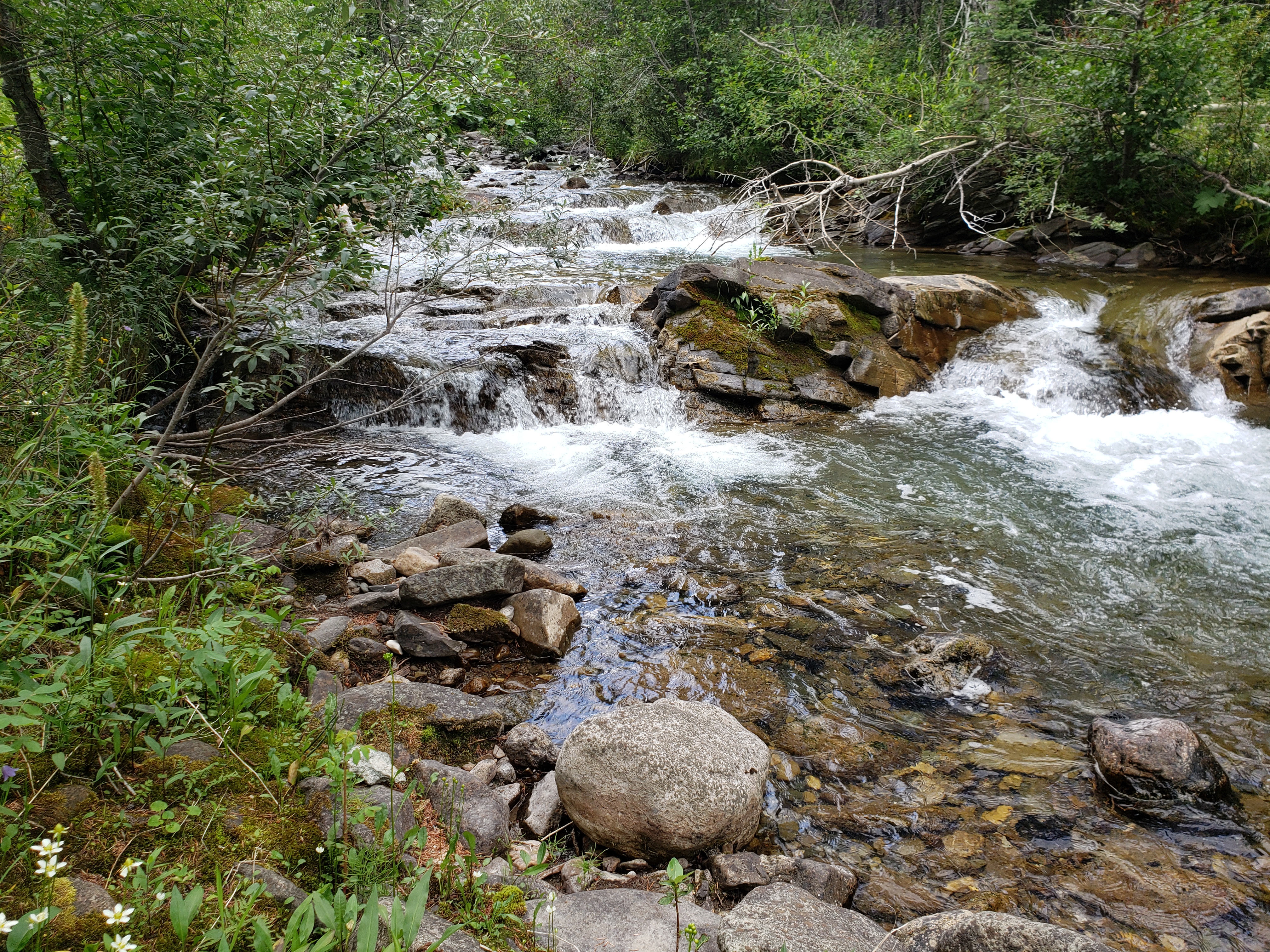
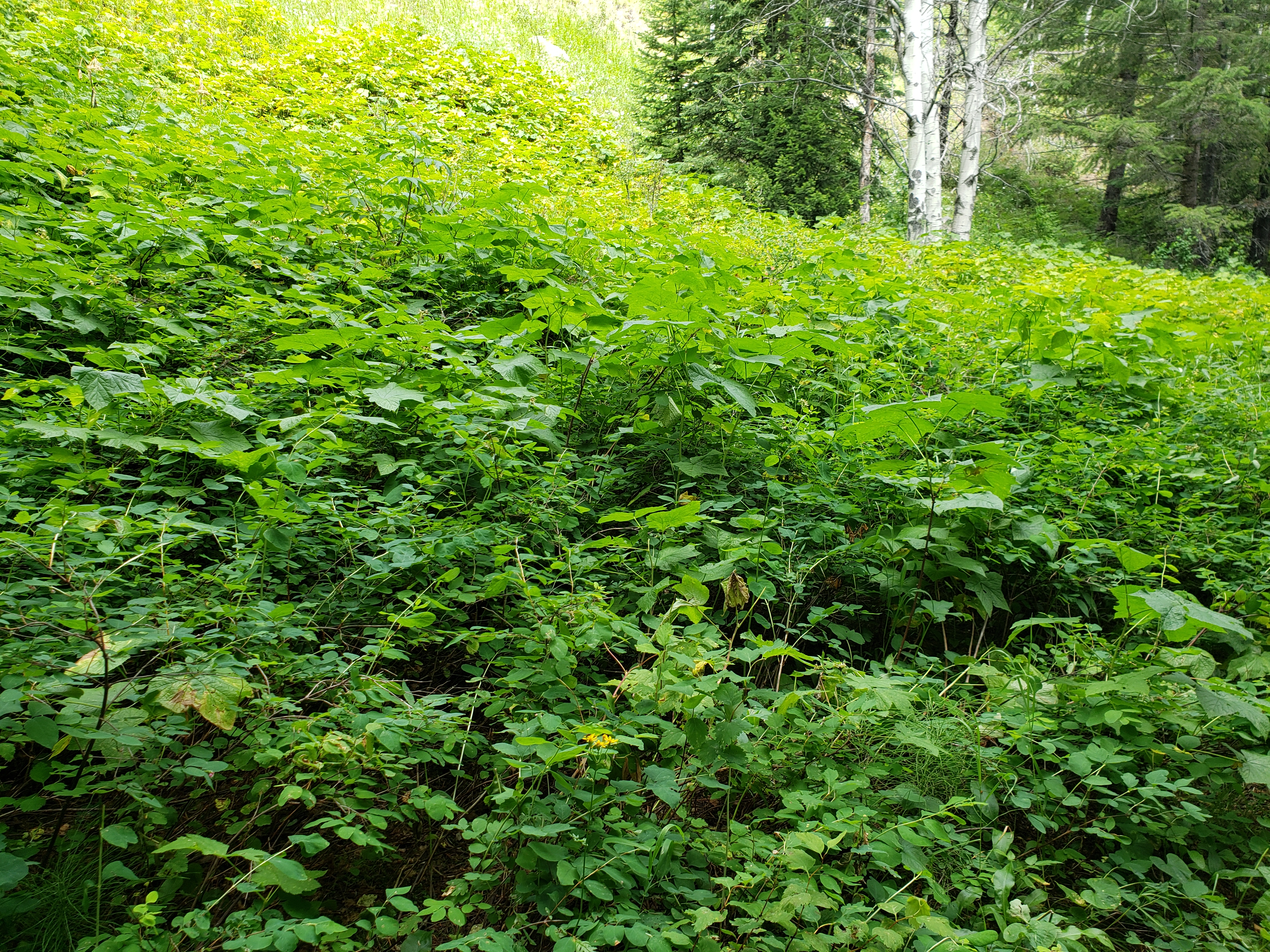
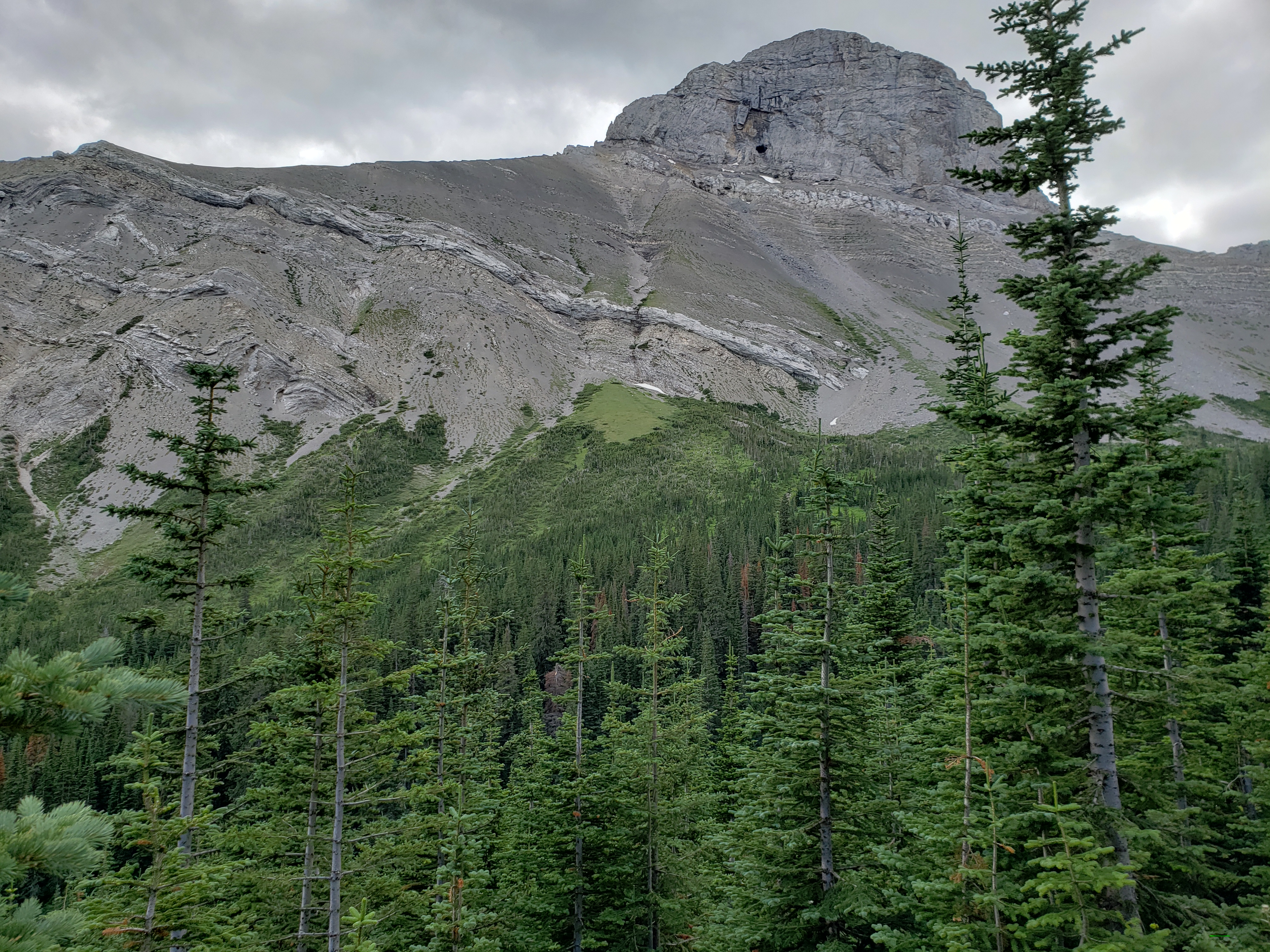
Along the way, we’d take pictures and marvel at the scenery.
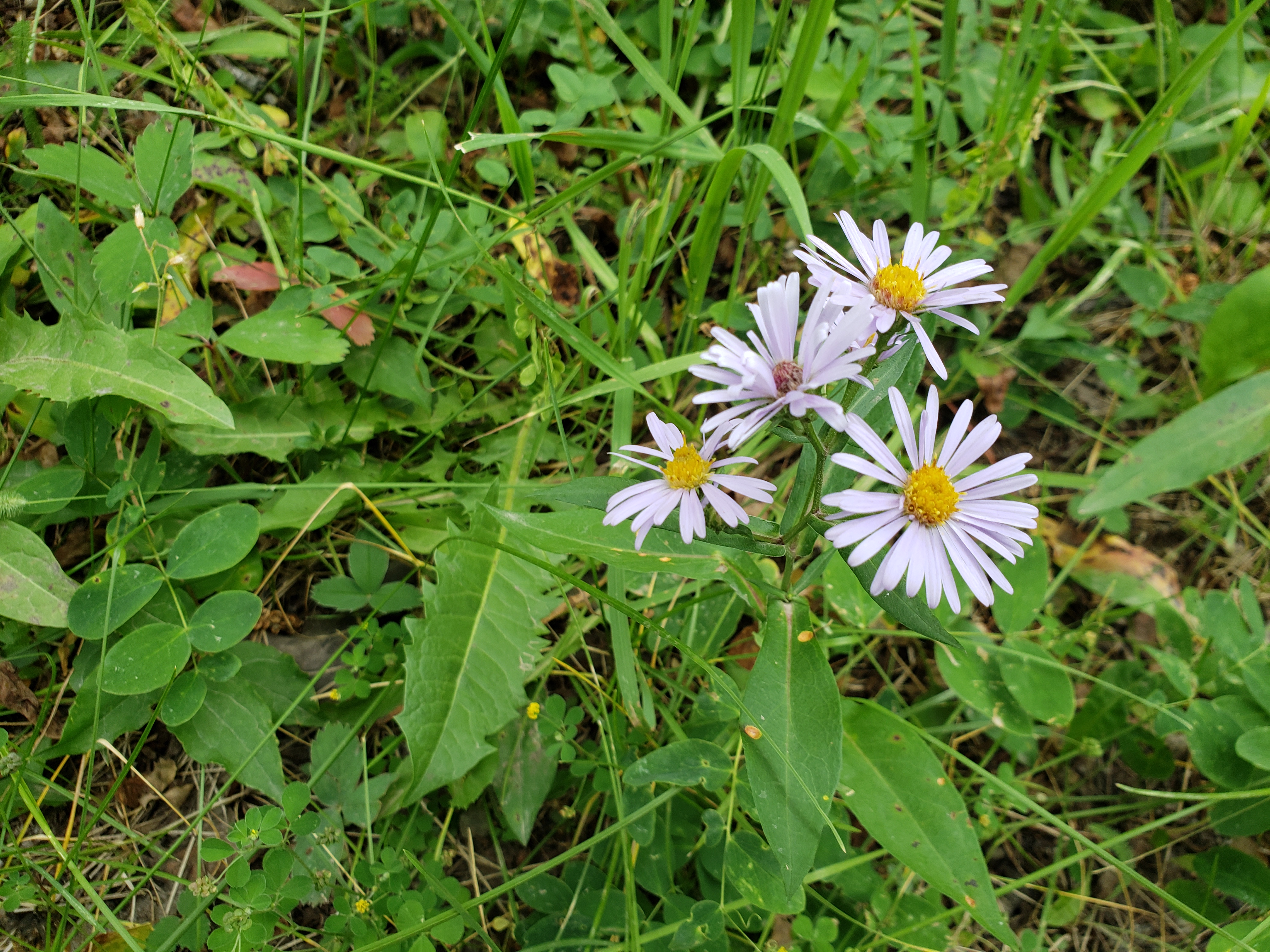
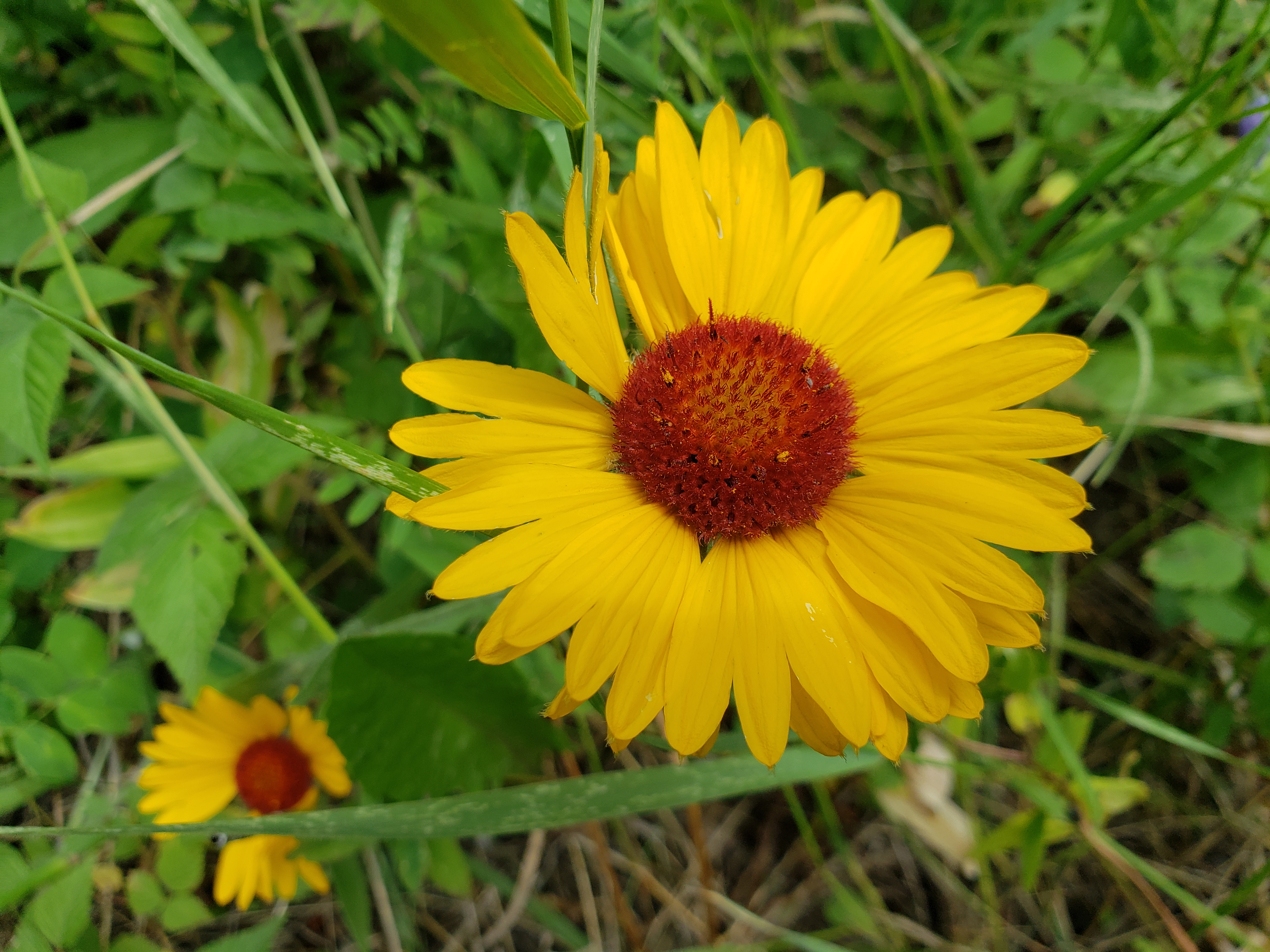
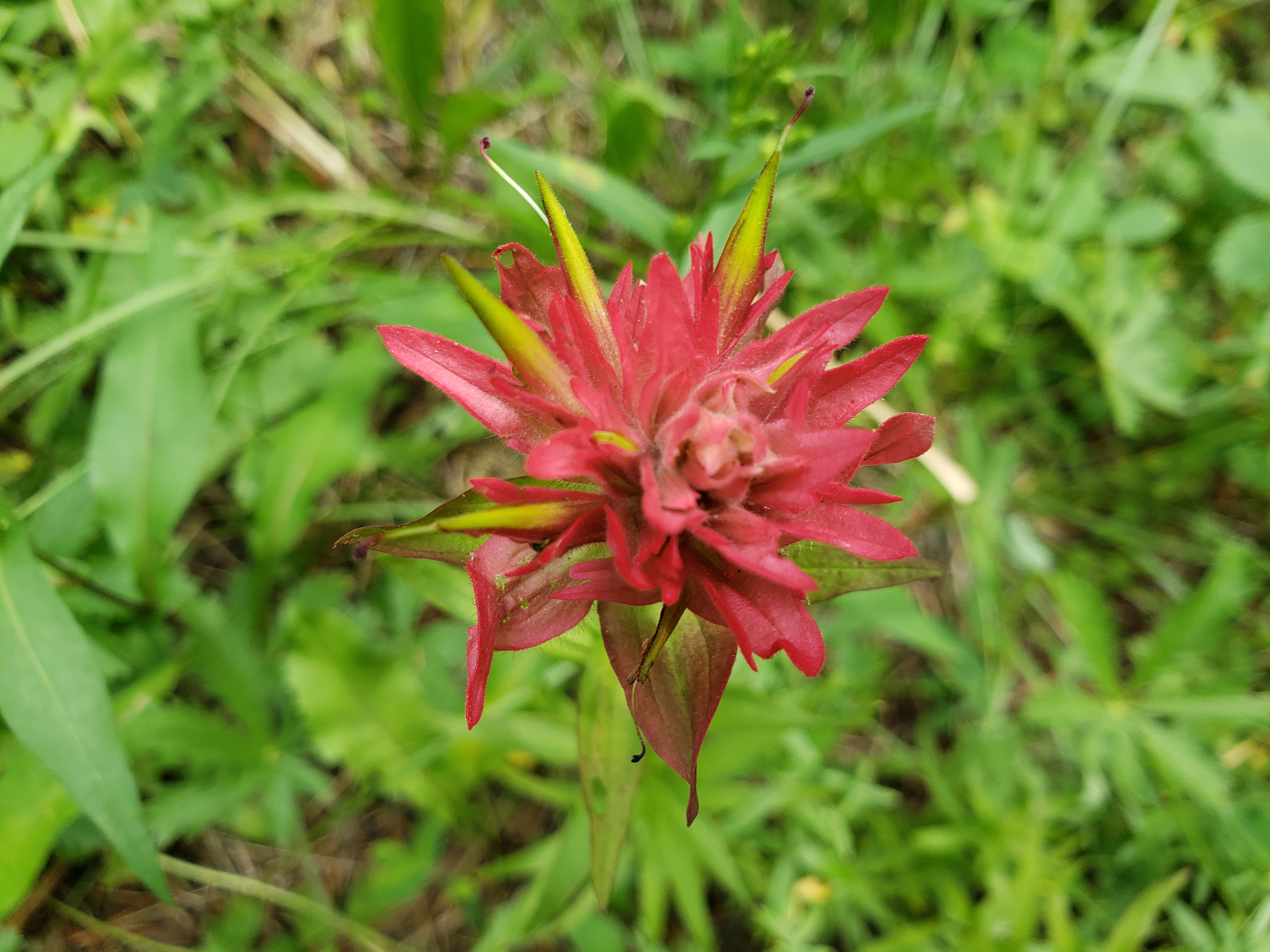
M was taking close-up pics of various things, so I thought I’d try the manual setting on my phone’s camera.
  8/8/2020 12:13 PM      3539113 North York Creek, AB hike 20200808_121352 pink flower.jpg
  8/8/2020 12:14 PM      4570171 North York Creek, AB hike 20200808_121447 yellow & white flower.jpg
  8/8/2020 12:33 PM      3932631 North York Creek, AB hike 20200808_123335 yellow flower.jpg
  8/8/2020 12:36 PM      8892256 North York Creek, AB hike 20200808_123645 yellow bridge.jpg
  8/8/2020 12:49 PM      4117120 North York Creek, AB hike 20200808_124901 red flower.jpg
Holy cow. They said in the brochure that it was a ‘moderate’ hike. The phrase, “Are we there yet?” came up in conversation all the way up. A few times Mo or I asked people coming down or quad drivers if we were heading in the right direction. “You’ve still got a long way to go.” Holy cow.
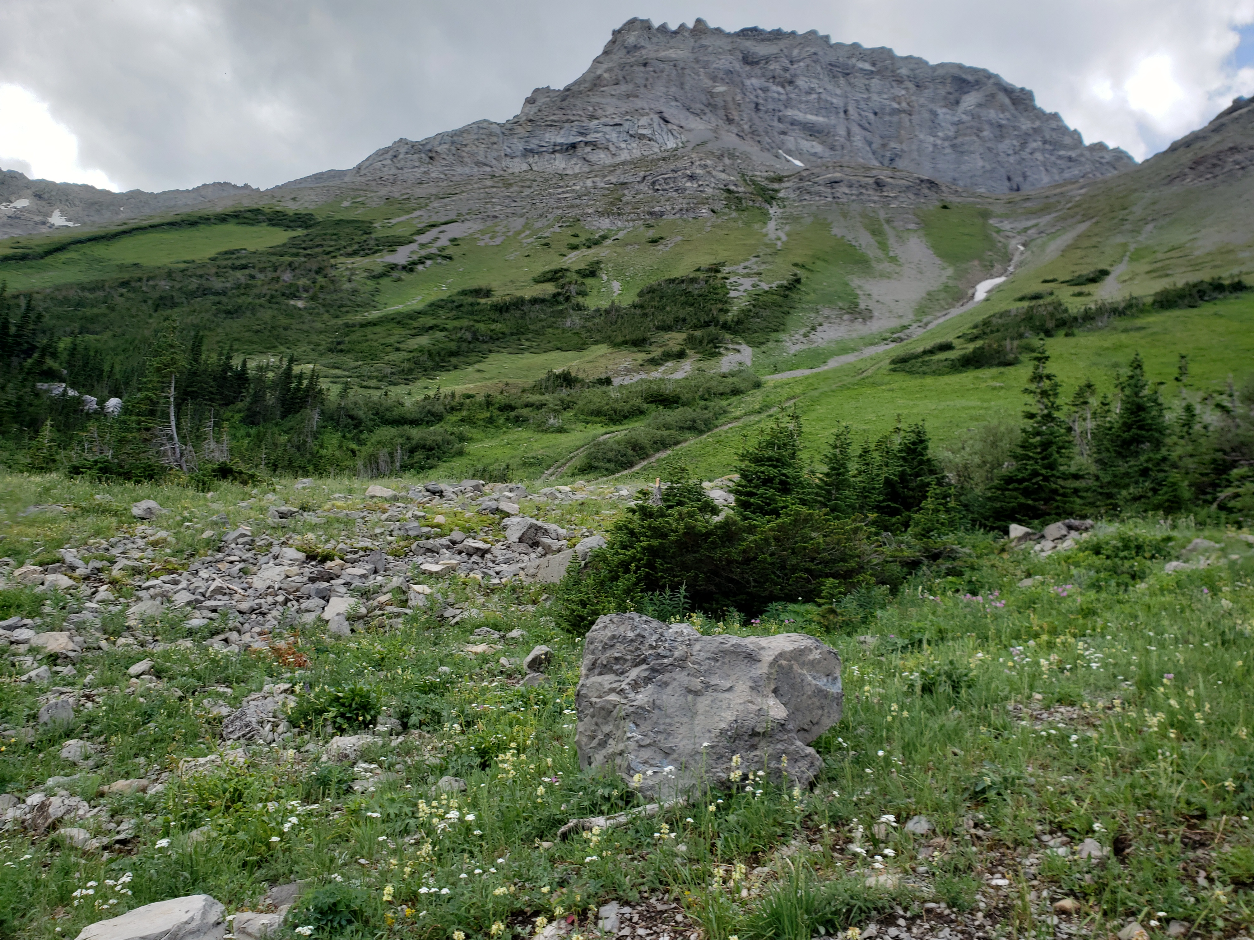
At some point, we reached a summit along the trail. “Not far to go now, I should think.”
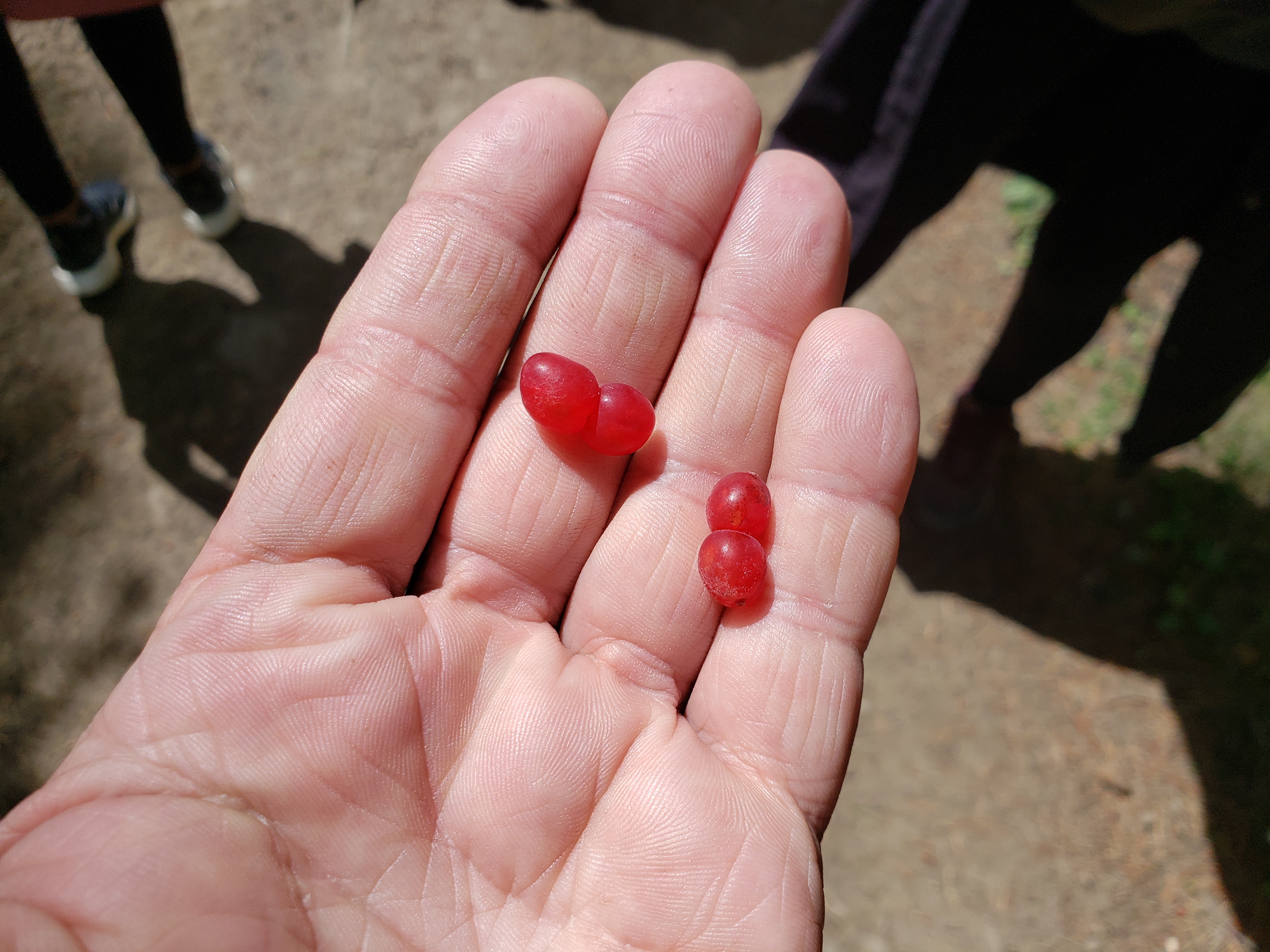
Wrong. We kept going and going and going. Z & C found lots of ‘twin berries’. We gobbled them up.
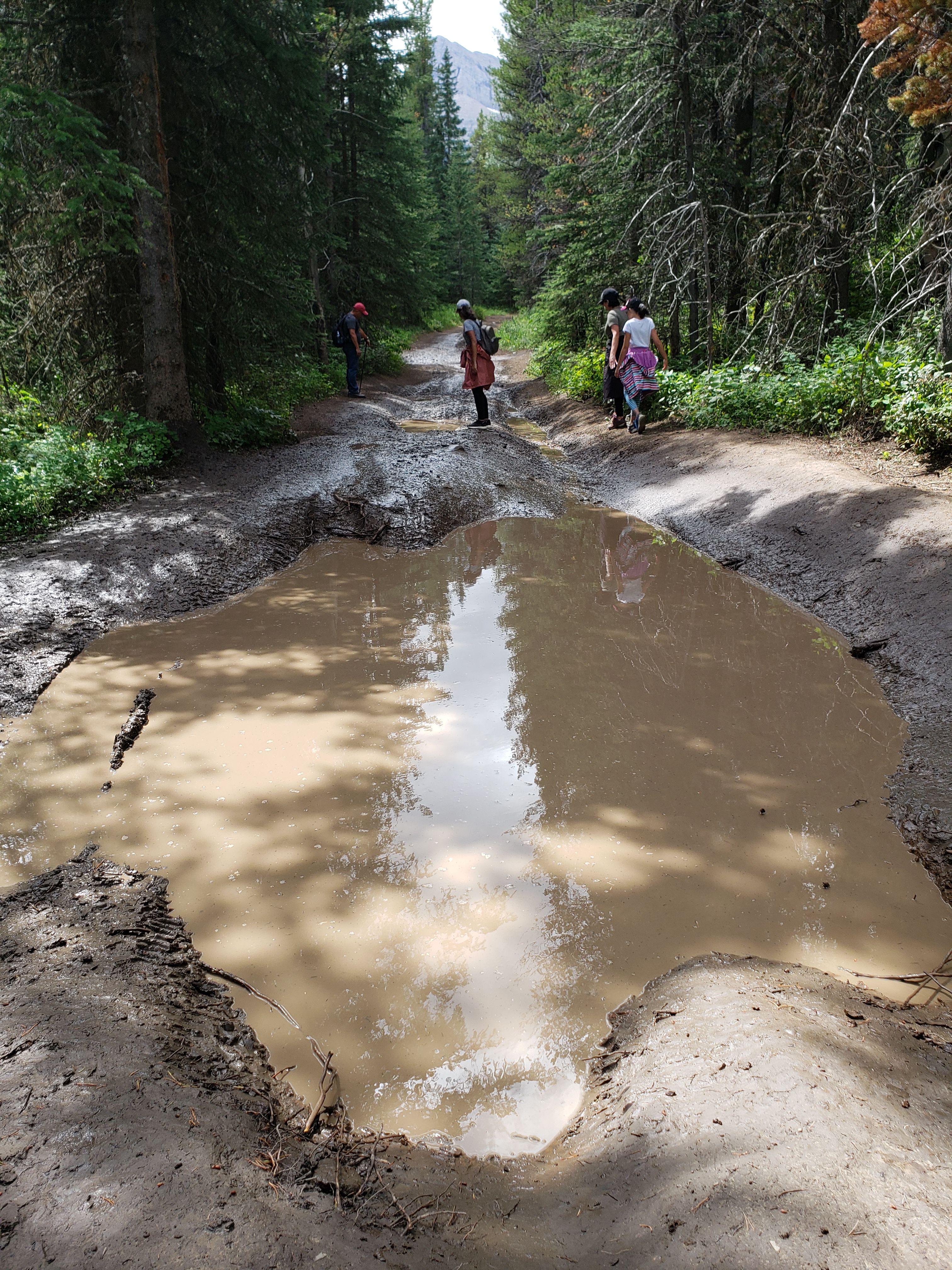
We hit a few muddy patches along the way.

We saw a sign. We finally made it! Except we didn’t. We all danced and sang and had fun until I hiked up a short-cut hill and met some other people who said, “Well … you’re not there yet. Still have a long way to go.”
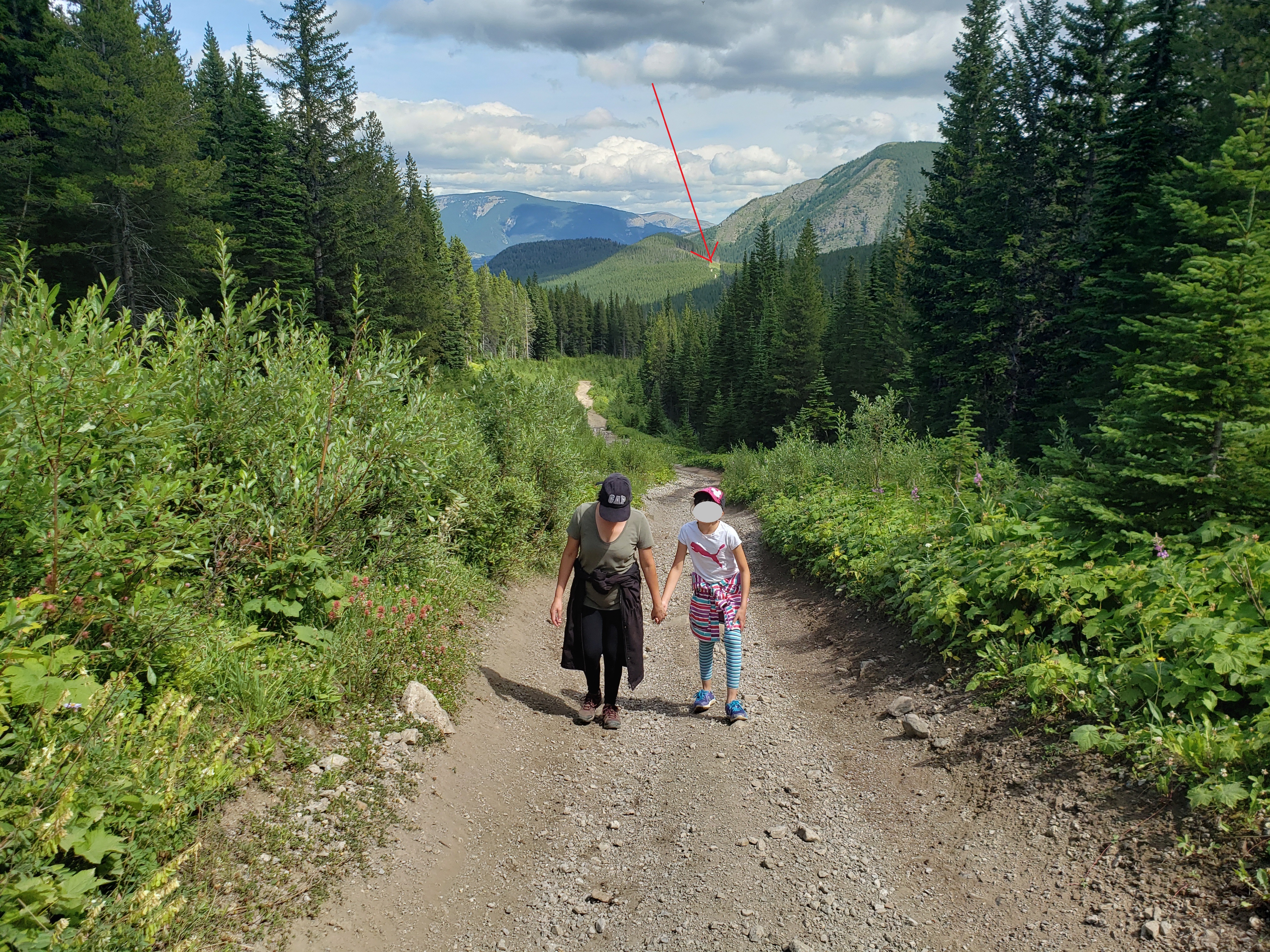
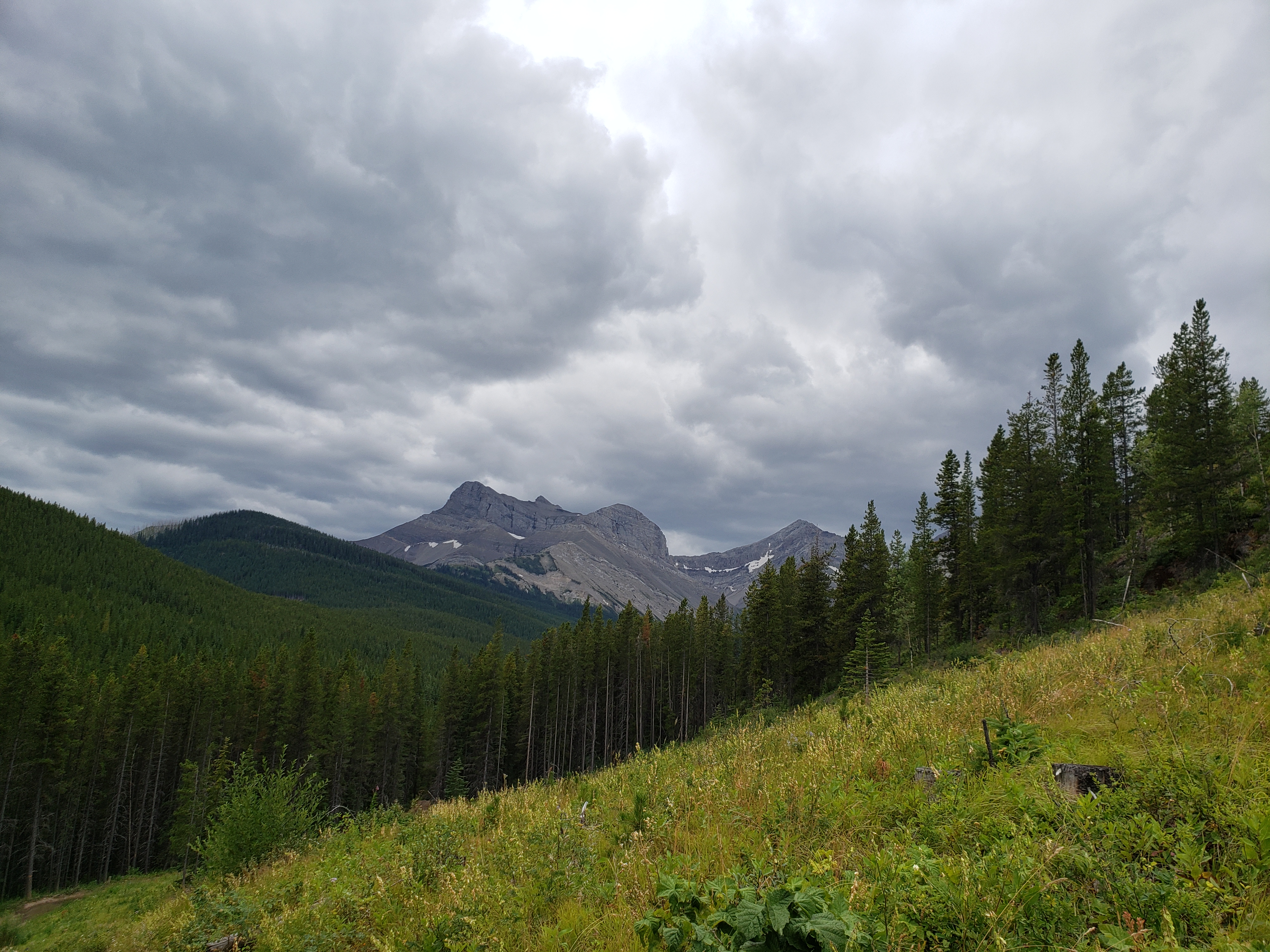
We looked back at from where we came. Wow.
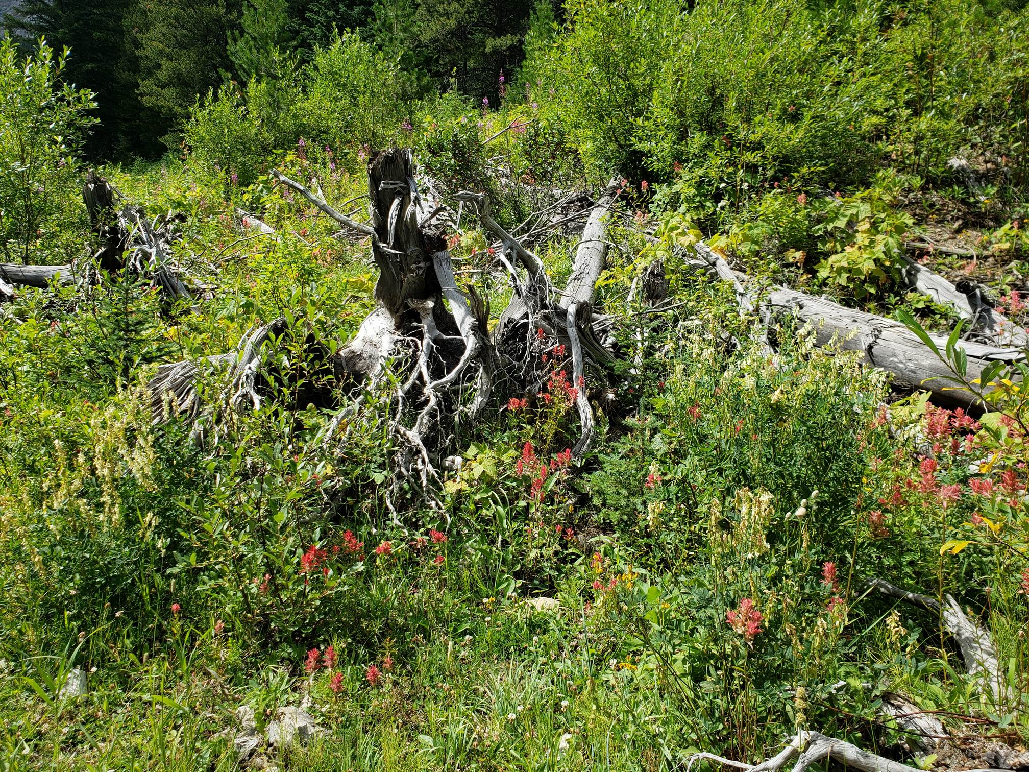
In a couple of our previous camps & hikes, M and I both found driftwood about two feet long that looked like something or that had an unusual shape. What for? Well, ’cause it looks cool, I guess. I suggested to M that we should bring this piece home. It’s only about 10 feet long. That should fit in the van, if everyone else sits on the roof.
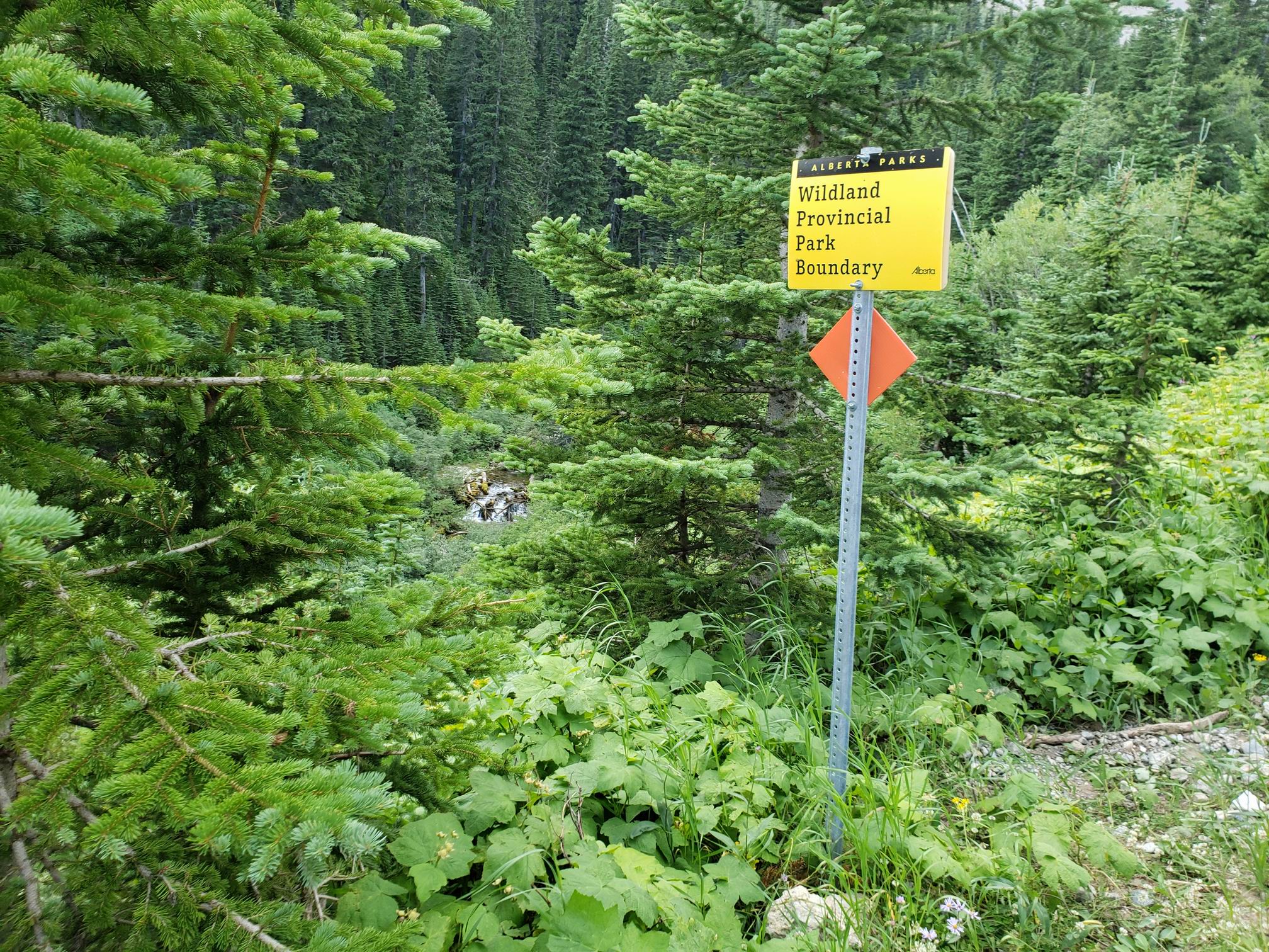
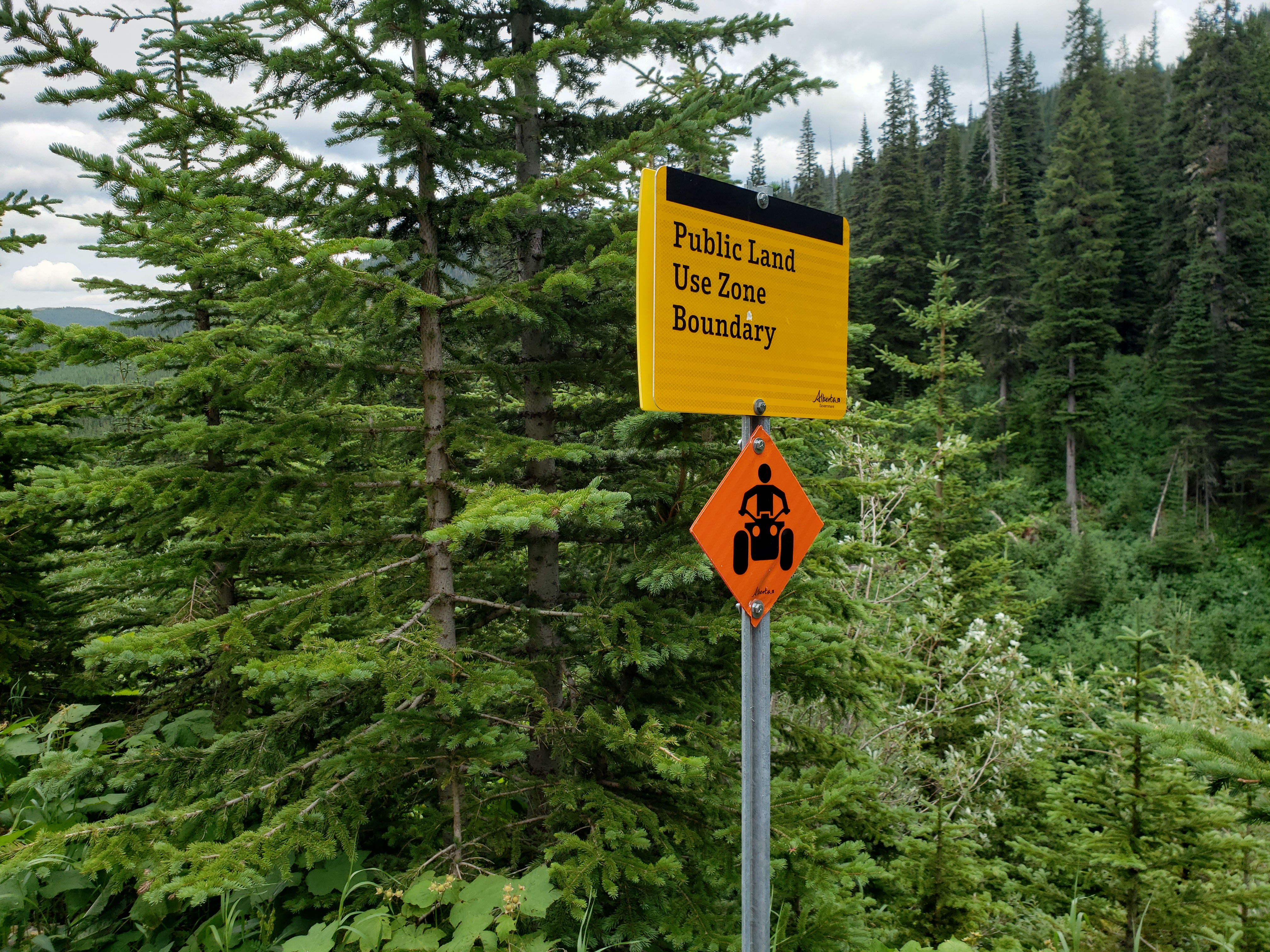
We came across a sign – “Wildlife Provincial Park Boundary” I had no idea if we were entering or exiting this wildlife provincial park.
Wow.
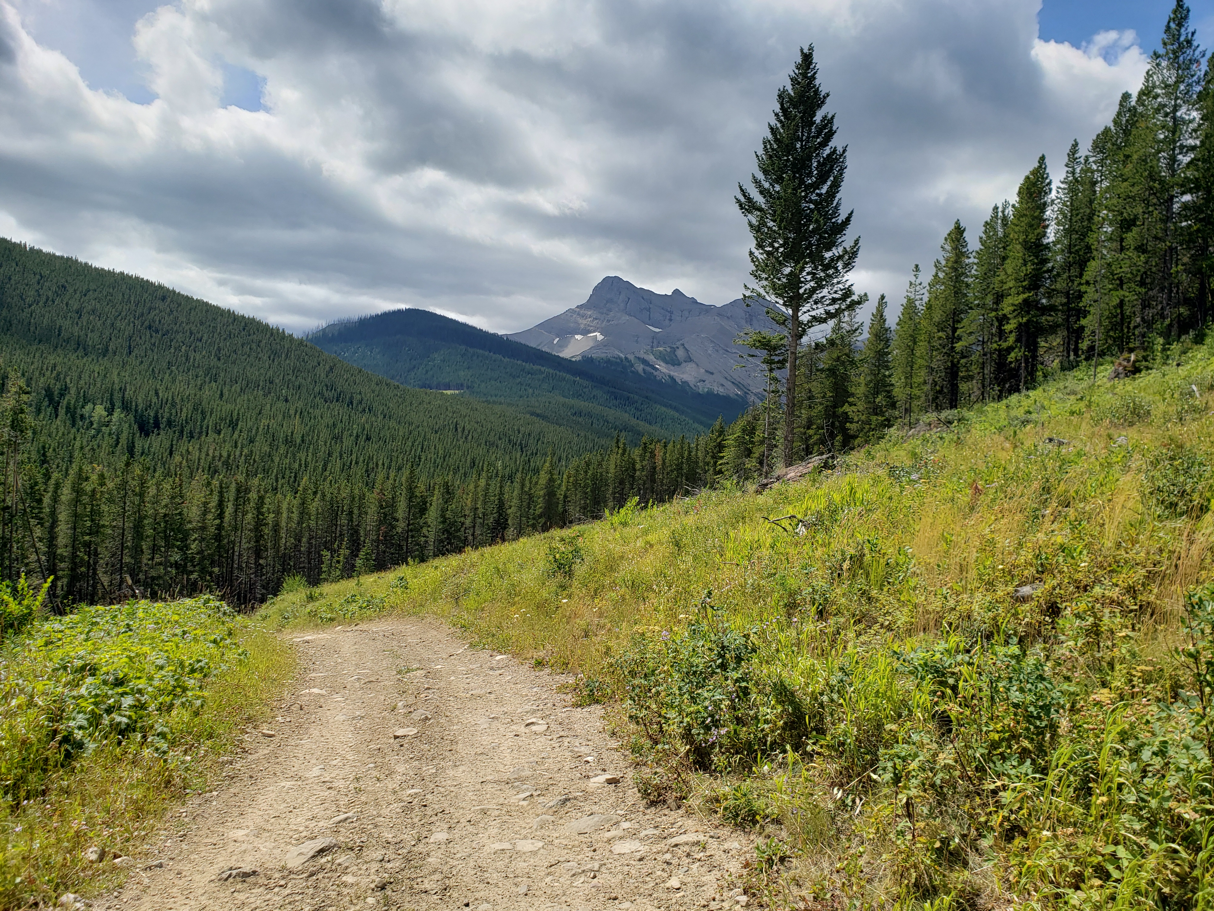
  8/8/2020  2:58 PM      5782013 North York Creek, AB hike 20200808_145845 mountain.jpg
  8/8/2020  3:03 PM      6428223 North York Creek, AB hike 20200808_150359 ATV & snow mobile path, mountain.jpg
  8/8/2020  3:09 PM    114232841 North York Creek, AB hike 20200808_150815 hike up steep trail.mp4
  8/8/2020  3:13 PM      5085217 North York Creek, AB hike 20200808_151321 countryside, mountain.jpg
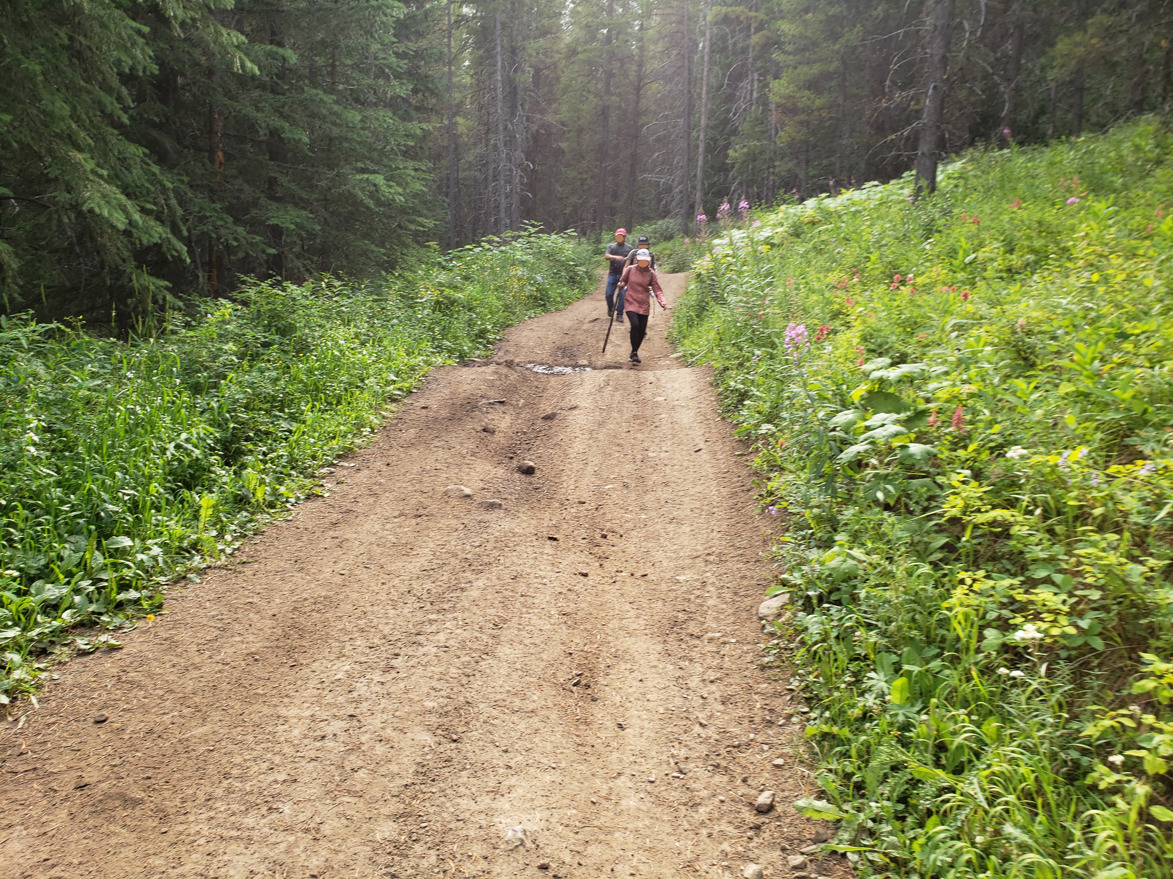
Mo & X were way up the trail. Because C is young, she couldn’t walk as fast. Only Mo and I had bear spray, which we wore outside on our belts, so I stuck close to M & C. I hiked ahead now and then to see if I could catch up to Mo & X. C & I yelled out into the mountain valleys a few times. Finally, faintly in the distance, we heard a reply. Were we getting close? By this time we crossed many seemingly significant signs that said we were nearing our destination.
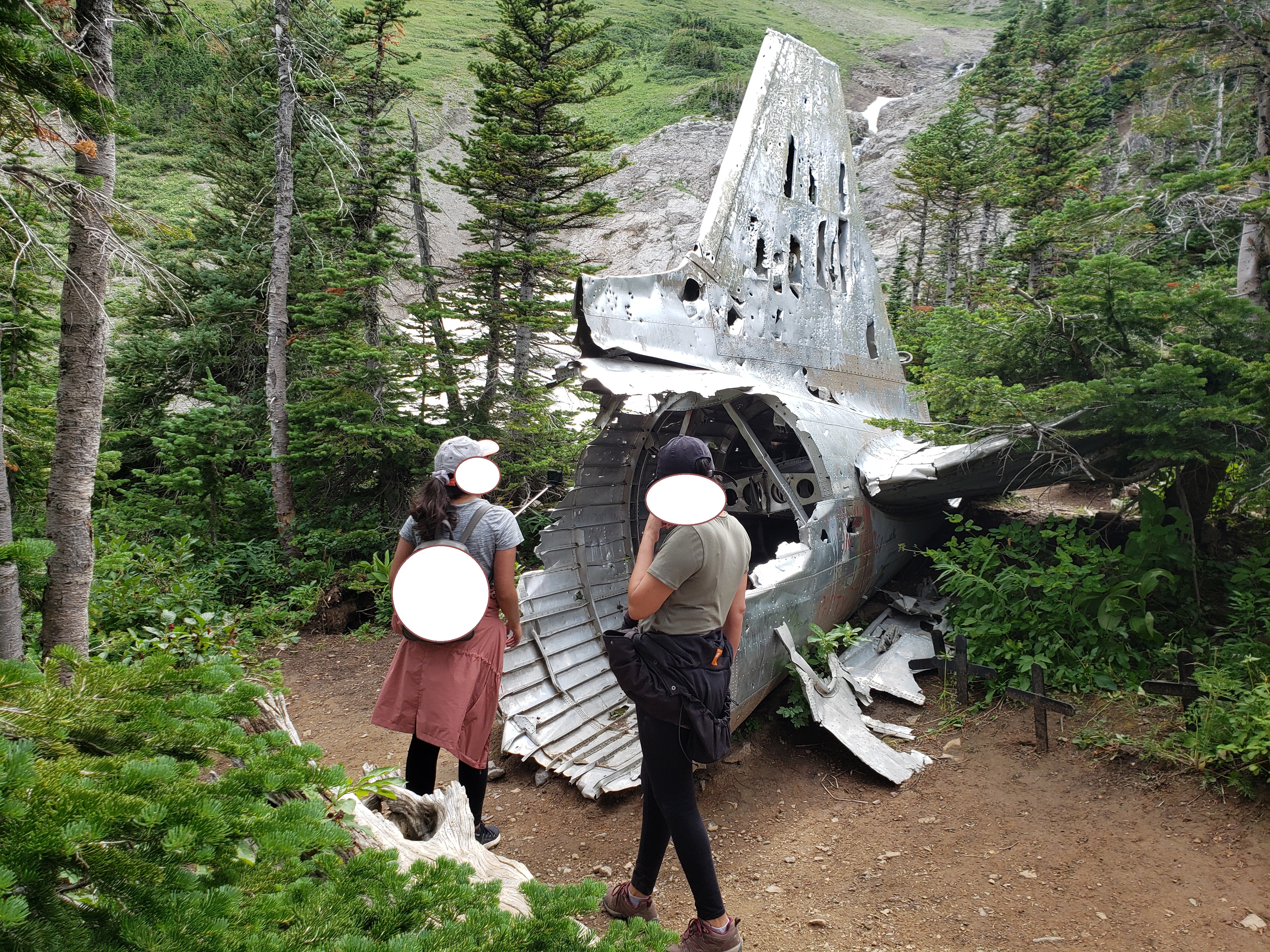
Suddenly, on one of my jaunts up to find Mo & X, I came across several groups at a bit of a clearning. I talked with one group. They said the crash site is “just over there. You made it. You’re here.” Yahoo!

(The videos are big, so they’ll take a while to download.)
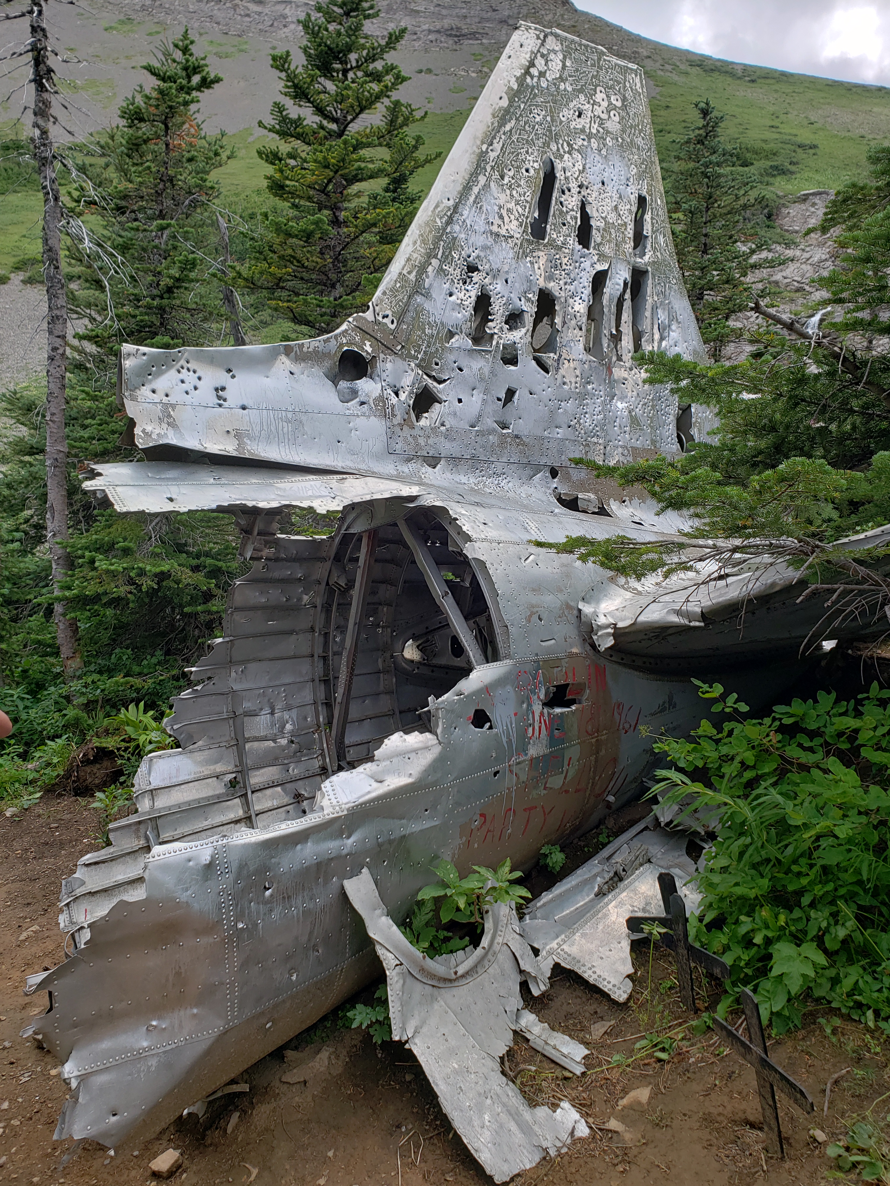
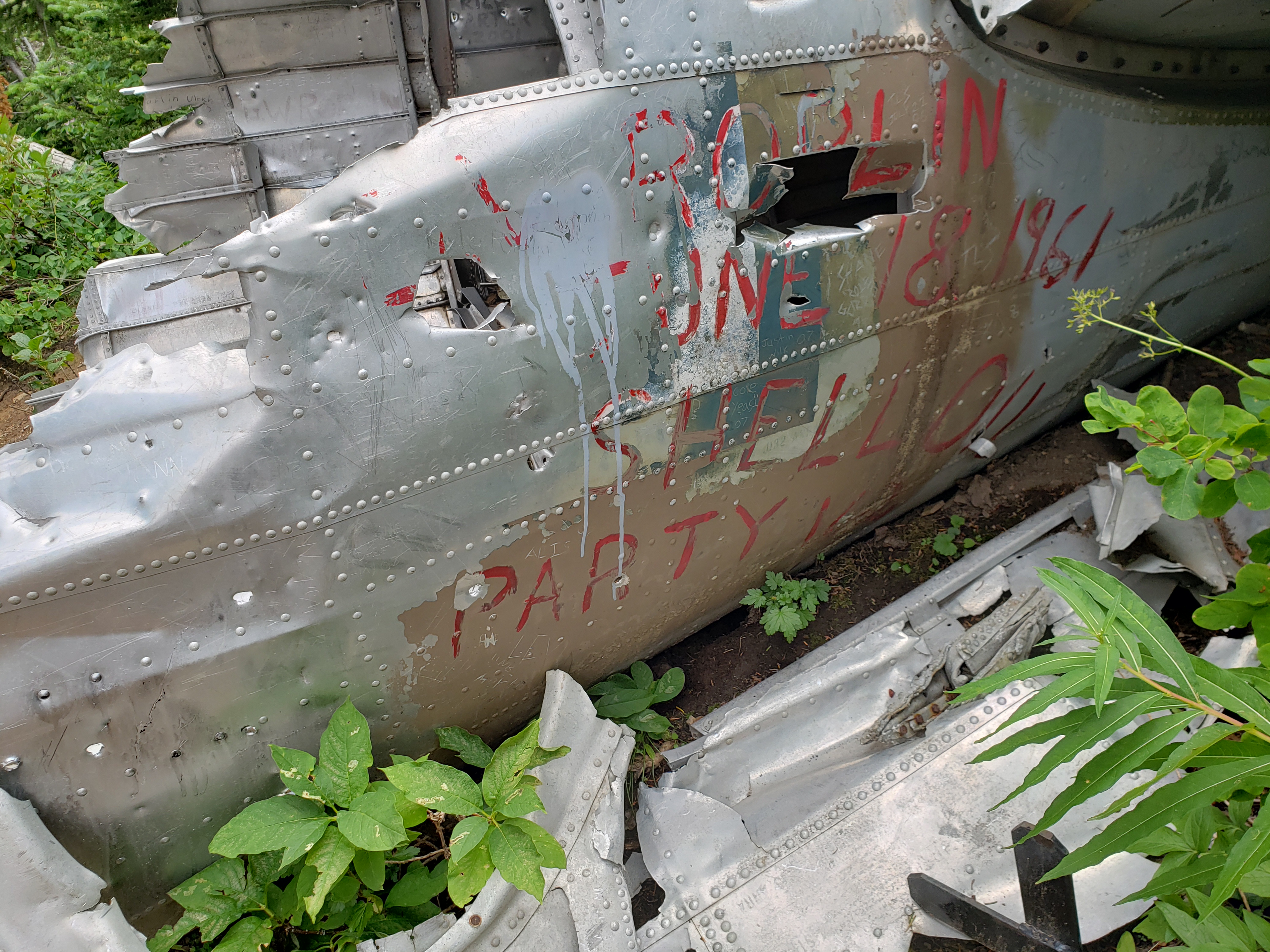
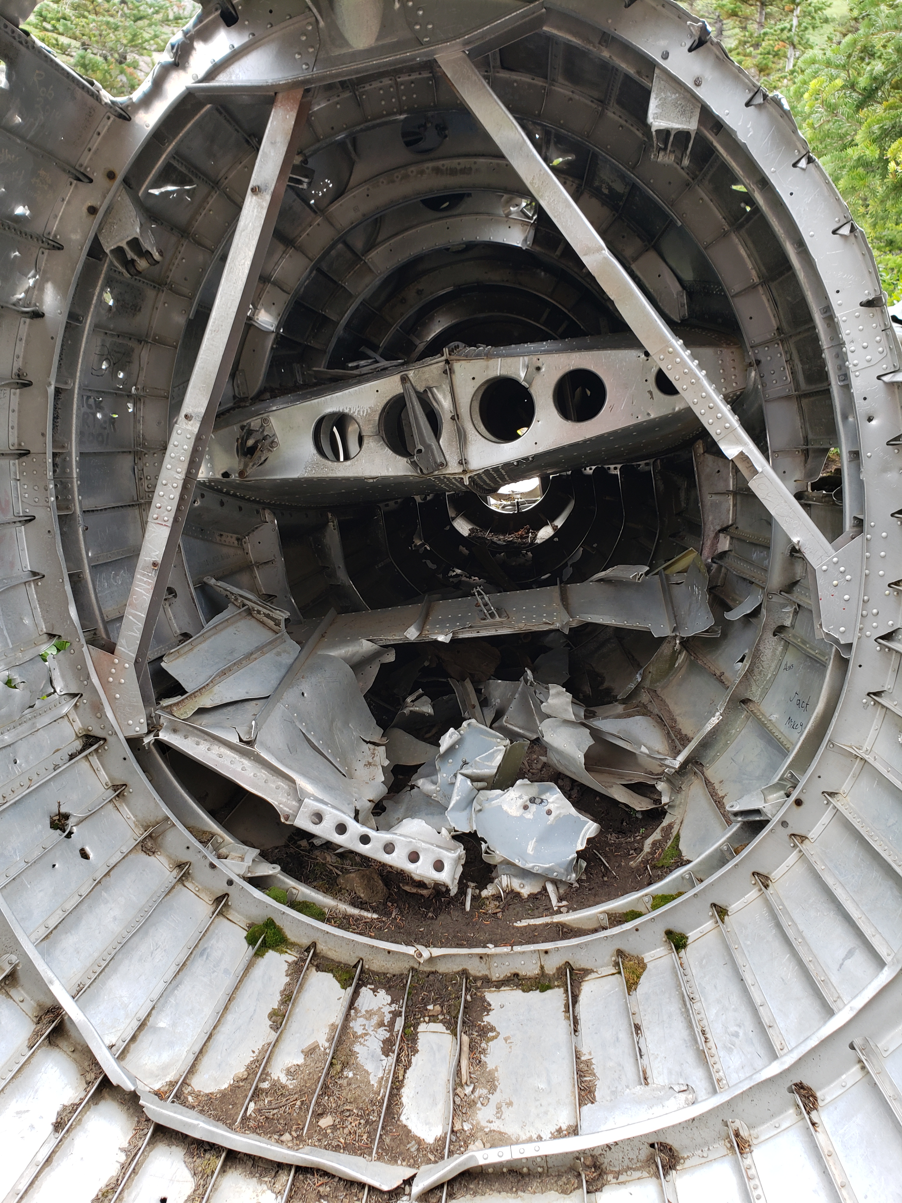
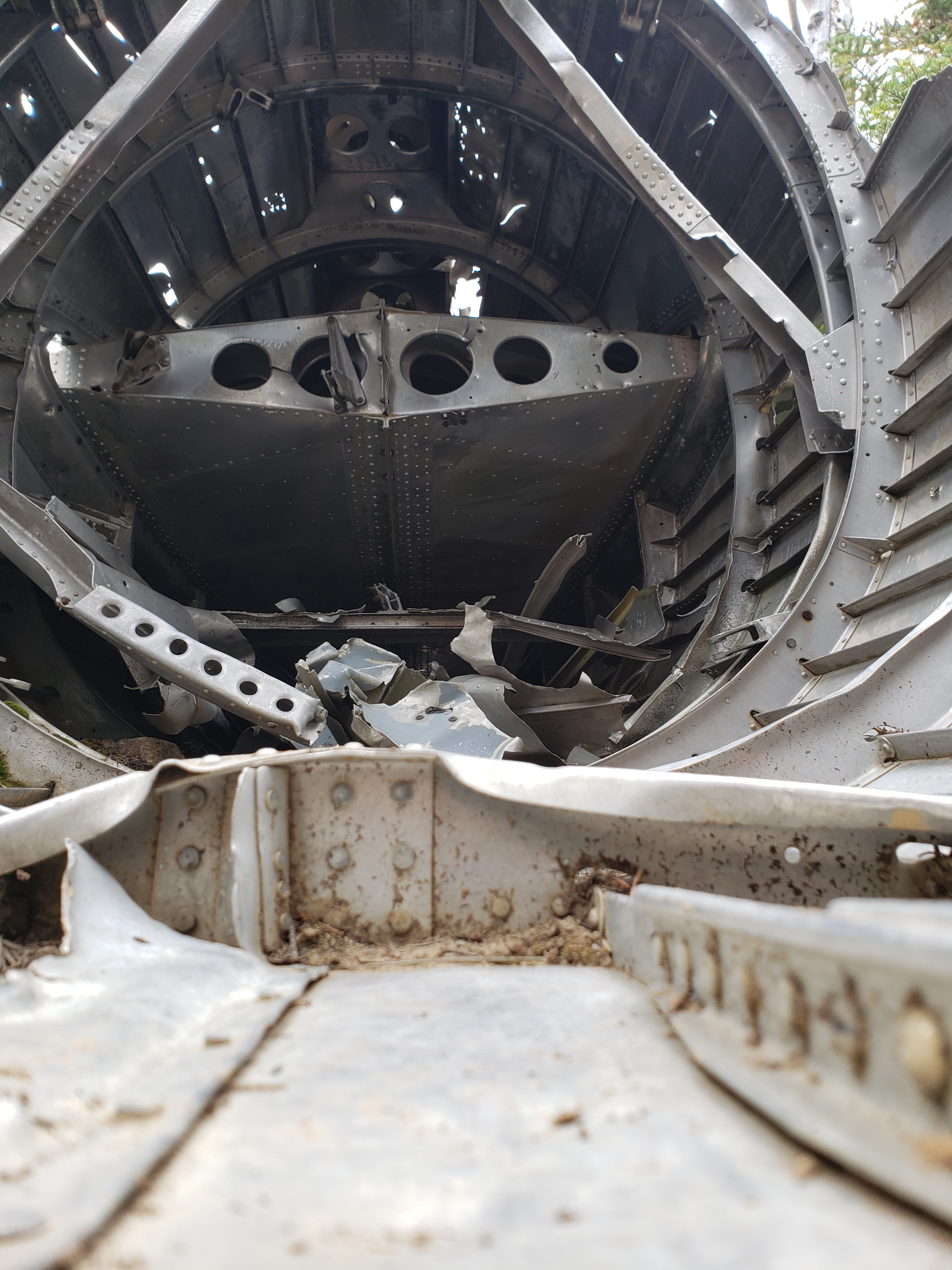
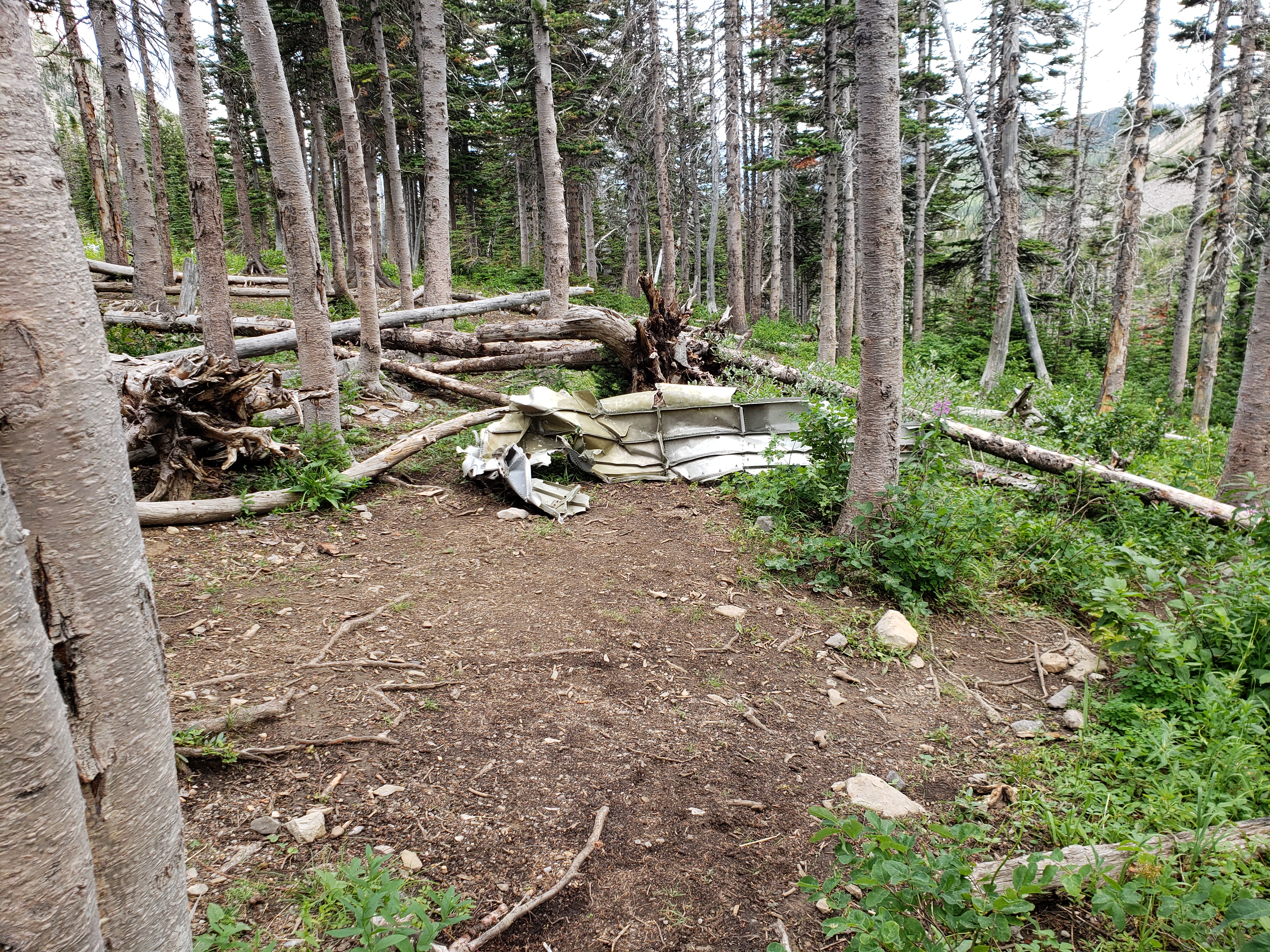
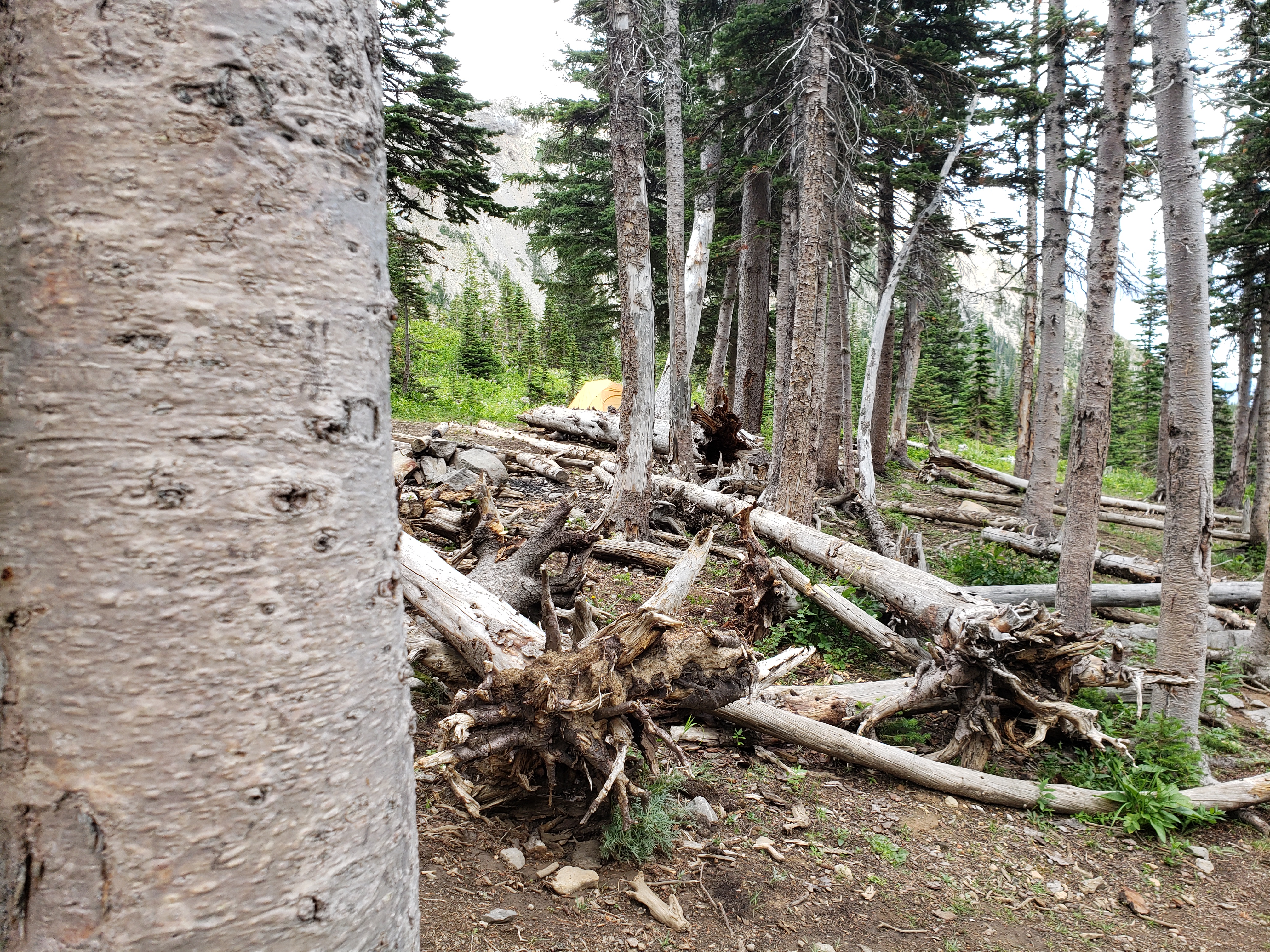
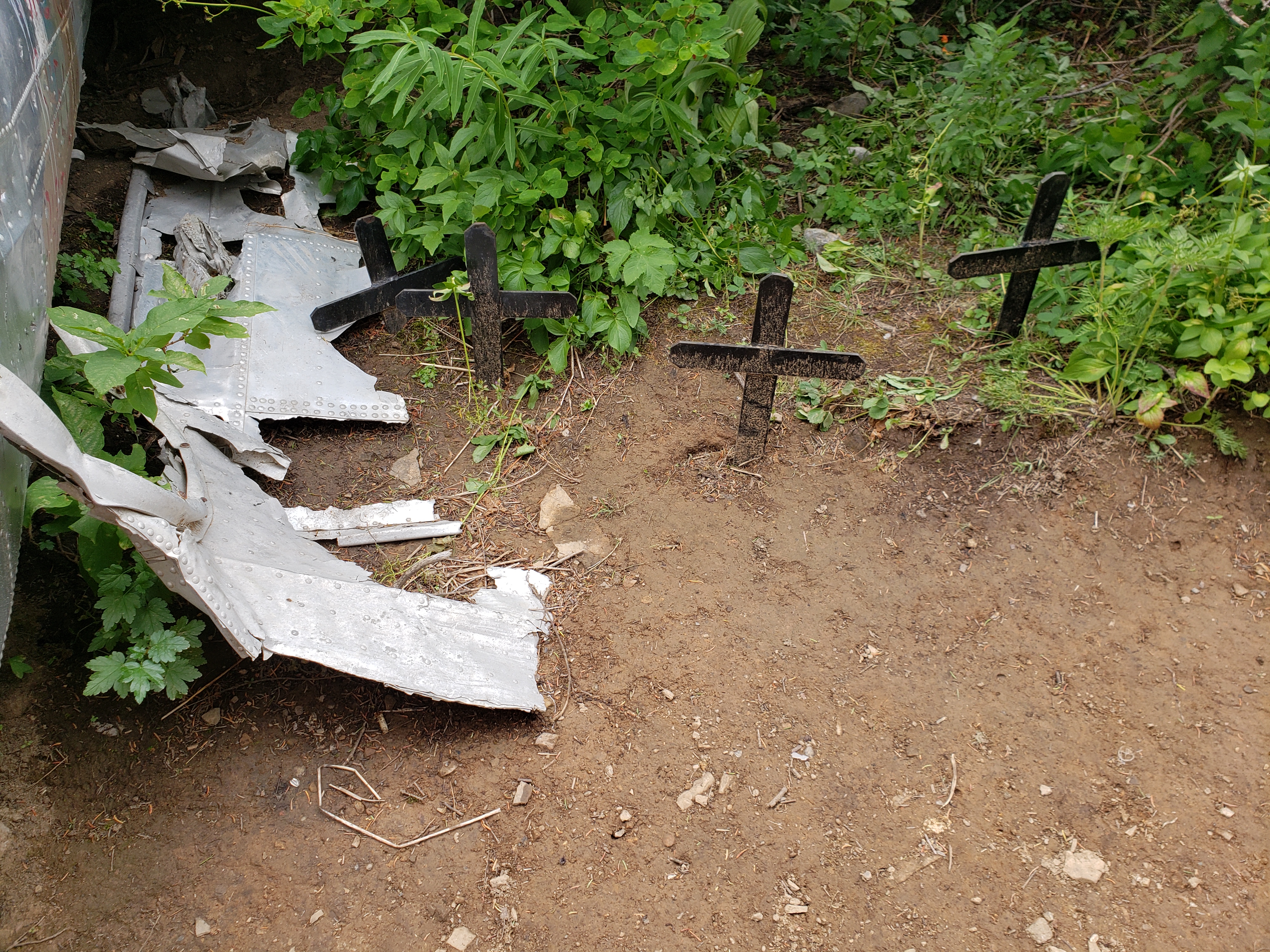
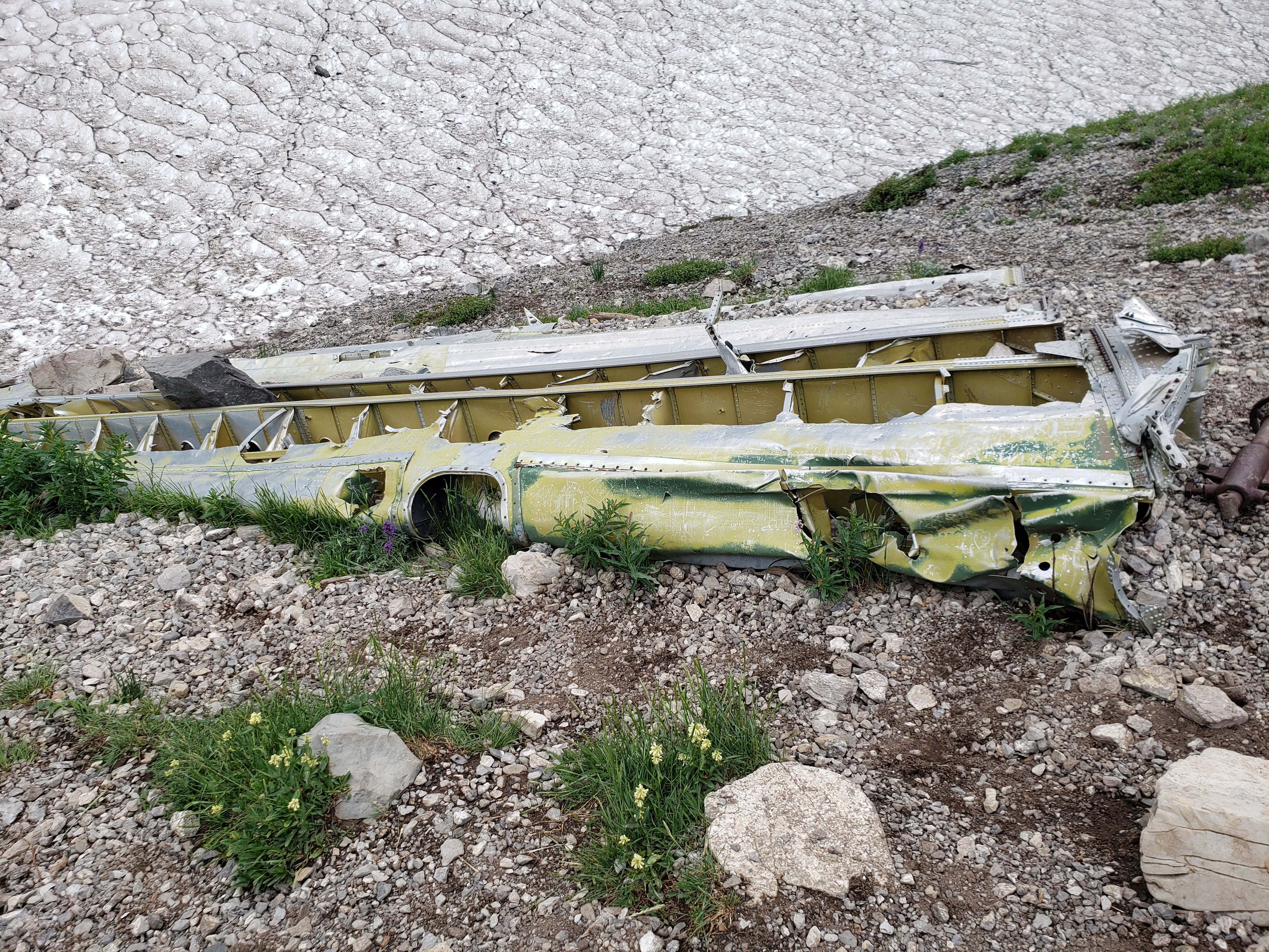
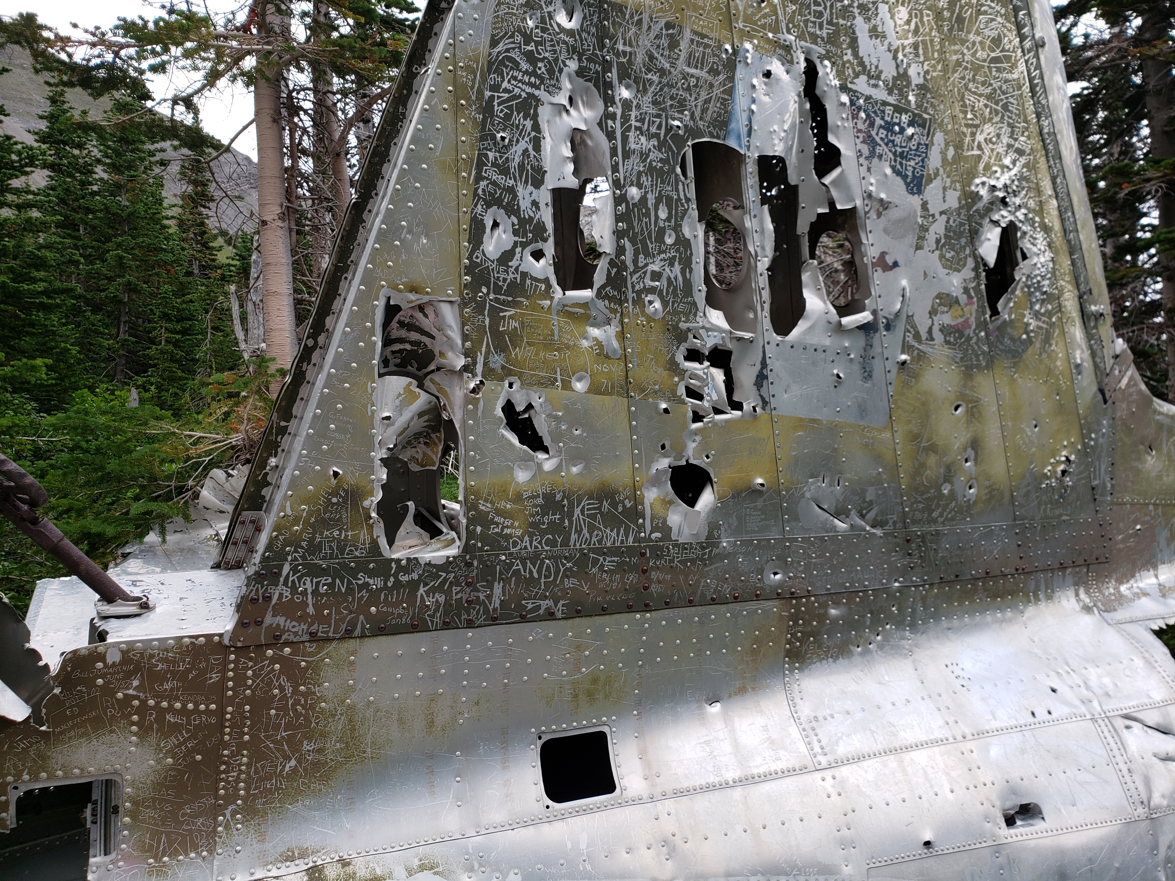
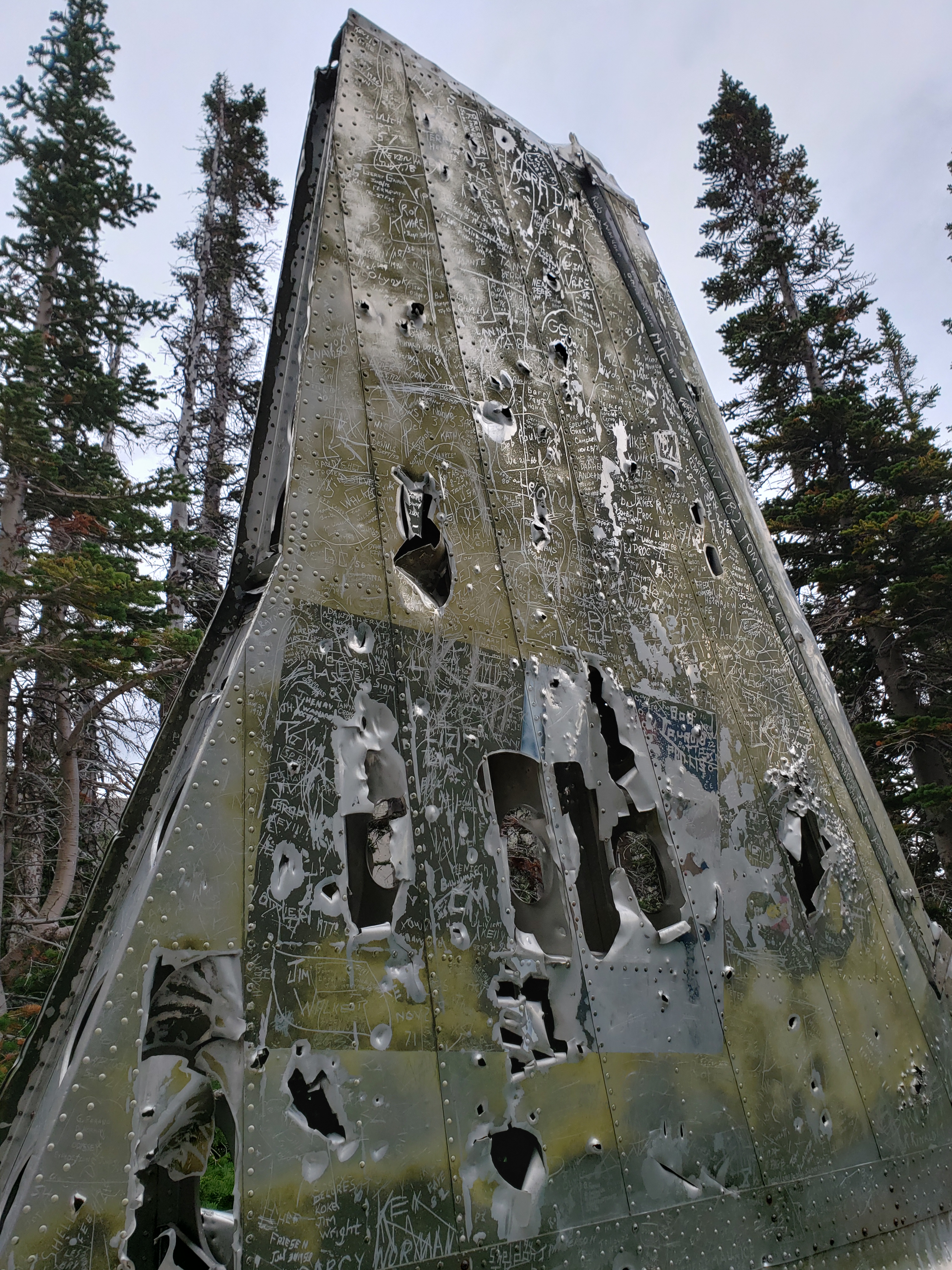
  8/8/2020  3:15 PM    310098115 North York Creek, AB hike 20200808_151327 walk along trail.mp4
 9/12/2020 11:27 AM      6751192 North York Creek, AB hike 20200808_152612 X, M at RCA DC-3 Dakota 1946 plane crash e1.jpg
 8/12/2020  5:51 PM      5429538 North York Creek, AB hike 20200808_152618 RCA DC-3 Dakota 1946 plane crash.jpg
  8/8/2020  3:26 PM      4147735 North York Creek, AB hike 20200808_152625 RCA DC-3 Dakota 1946 plane crash.jpg
 8/12/2020  5:51 PM      4404003 North York Creek, AB hike 20200808_152633 RCA DC-3 Dakota 1946 plane crash.jpg
 8/12/2020  5:51 PM      3703977 North York Creek, AB hike 20200808_152637 RCA DC-3 Dakota 1946 plane crash.jpg
  8/8/2020  3:26 PM      4053881 North York Creek, AB hike 20200808_152642 RCA DC-3 Dakota 1946 plane crash.jpg
  8/8/2020  3:26 PM      8460630 North York Creek, AB hike 20200808_152657 RCA DC-3 Dakota 1946 plane crash debris.jpg
  8/8/2020  3:27 PM      7116266 North York Creek, AB hike 20200808_152702 tent.jpg
  8/8/2020  3:27 PM      6841143 North York Creek, AB hike 20200808_152718 RCA DC-3 Dakota 1946 plane crash memorial markers.jpg
  8/8/2020  3:27 PM      6201054 North York Creek, AB hike 20200808_152724 RCA DC-3 Dakota 1946 plane crash memorial markers.jpg
  8/8/2020  3:29 PM    172218216 North York Creek, AB hike 20200808_152813 down to snow & creek.mp4
  8/8/2020  3:30 PM      7099623 North York Creek, AB hike 20200808_153034 RCA DC-3 Dakota 1946 plane crash debris, snow.jpg
I mentioned to them that I’d best go back to my group since I’m the only one of us with bear spray. They said there were lots of bears in this area but that black bears generally shy away from trails with lots of people, quads, & dirt bikes. I said, “Well, at least they’re just black bears.” One guy said, “And grizzlies, too.” … I felt the blood flush from my face. Good god. I’d best get down there to meet my group.
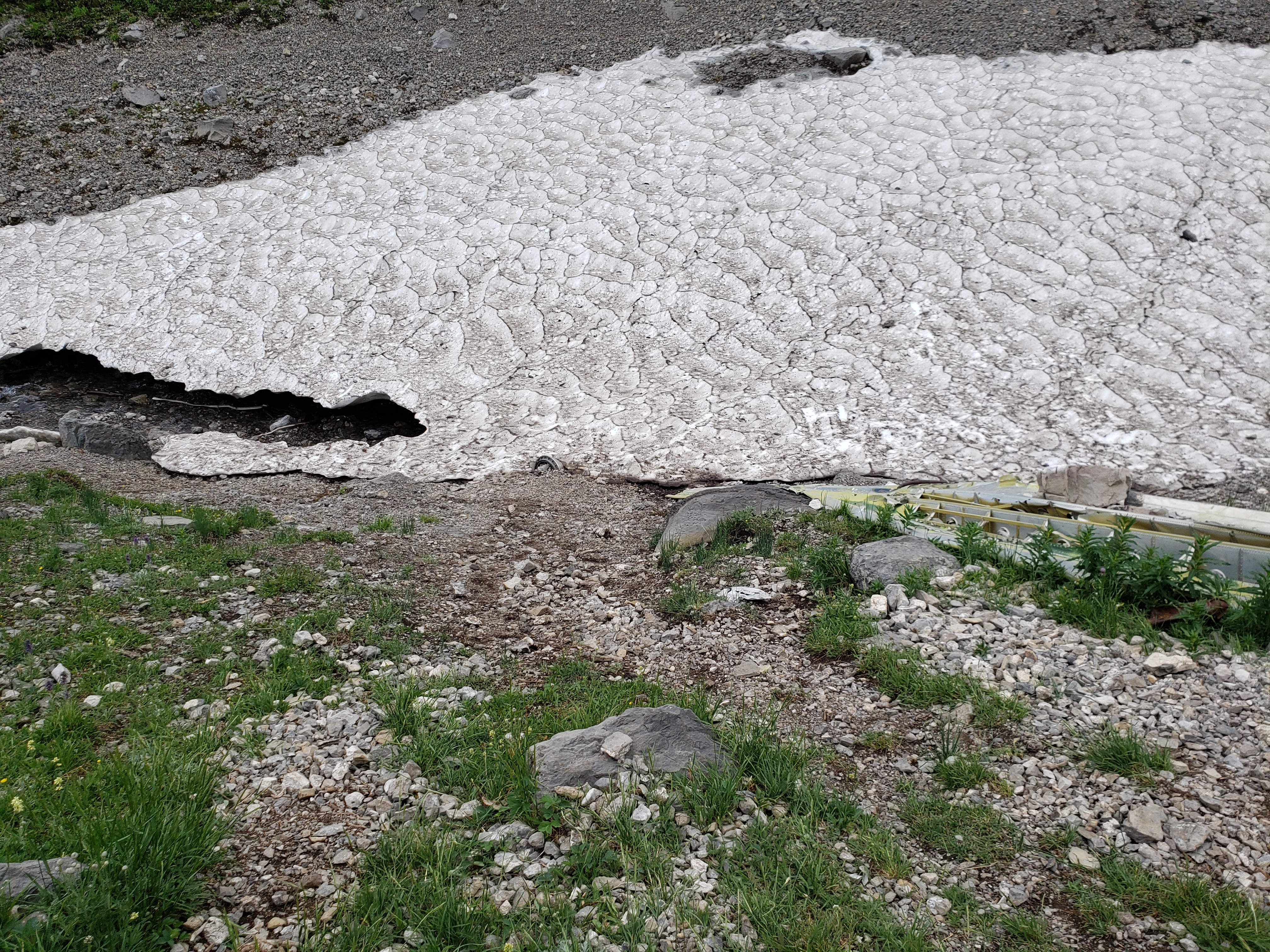
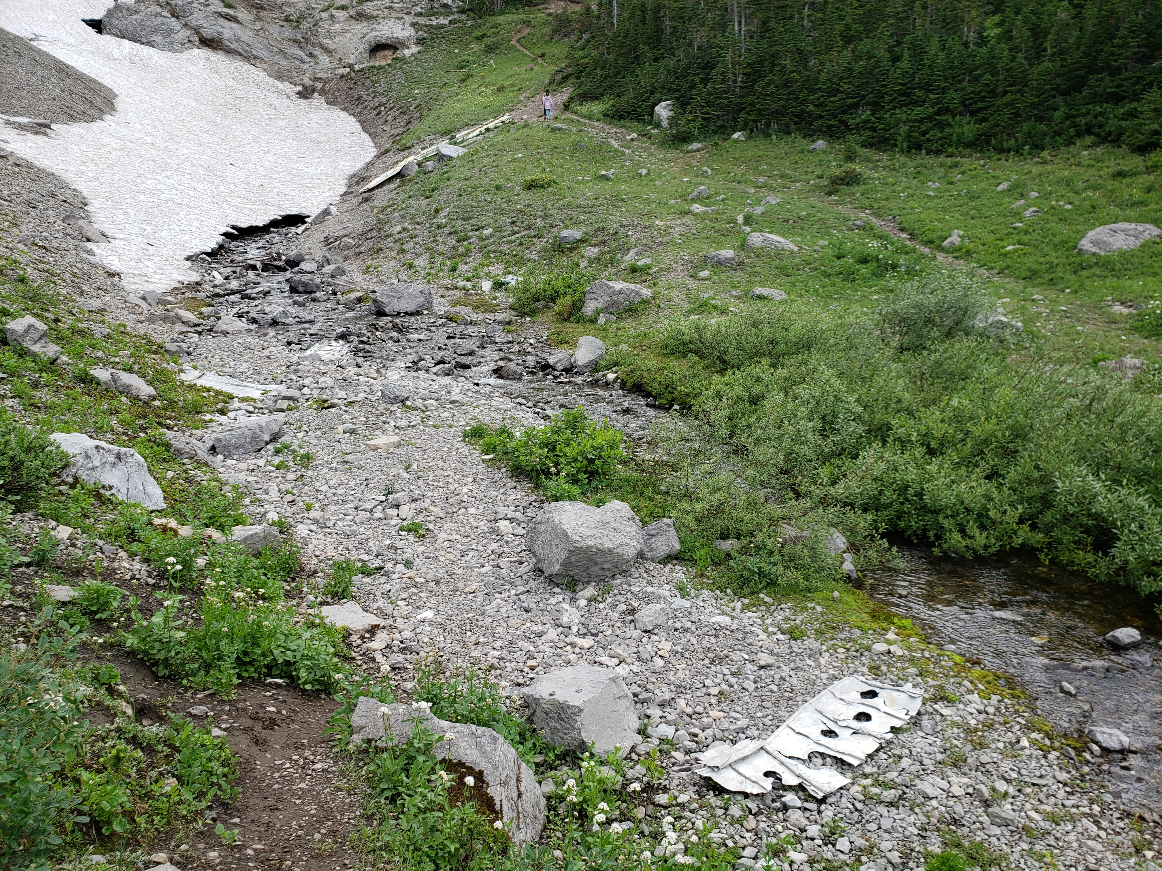
I found them just on their way up. We made it! Actually made it. It was a gruelling 4 hours from getting out of the van to reaching the crash site. There was snow covering most of the creek, albeit pretty rugged, dirty snow, but snow nonetheless. We milled around the crash site for a while. But none of us could find Mo. I got worried. Grizzlies in the area – and no Mo. This did more than worry me. We spread out, calling his name. Nothing.
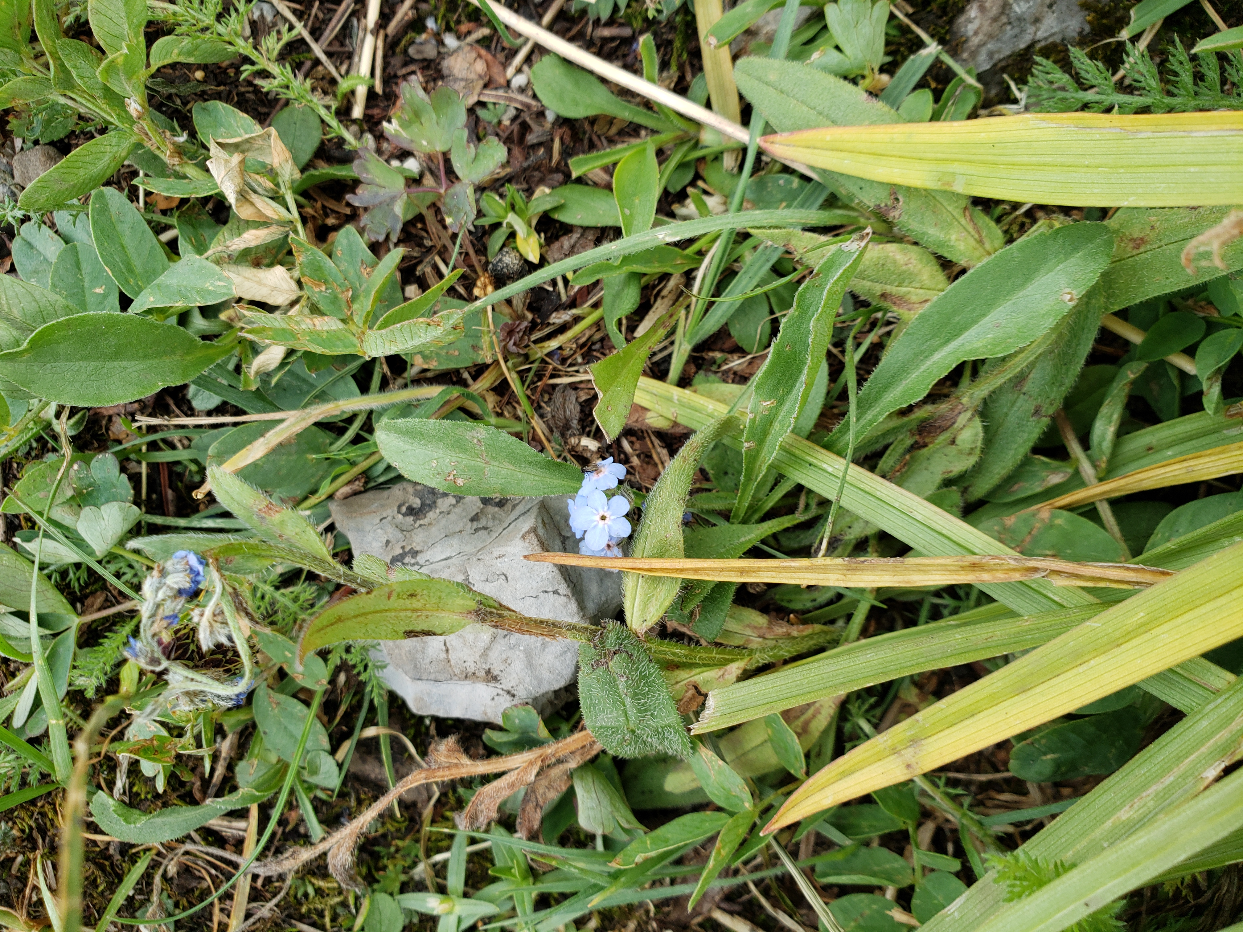
  8/8/2020  3:30 PM      7494638 North York Creek, AB hike 20200808_153040 RCA DC-3 Dakota 1946 plane crash debris, snow.jpg
 9/12/2020 11:40 AM      6369554 North York Creek, AB hike 20200808_153112 M at RCA DC-3 Dakota 1946 plane crash e1.jpg
\  8/8/2020  3:37 PM      5309505 North York Creek, AB hike 20200808_153732 tiny blue flower.jpg
  8/8/2020  3:37 PM      7785255 North York Creek, AB hike 20200808_153744 RCA DC-3 Dakota 1946 plane crash debris.jpg
  8/8/2020  3:40 PM      5457165 North York Creek, AB hike 20200808_154039 RCA DC-3 Dakota 1946 plane crash.jpg
 8/12/2020  5:51 PM      5075440 North York Creek, AB hike 20200808_154044 RCA DC-3 Dakota 1946 plane crash.jpg
As it turns out, Mo was way up another trail checking out the hole in the ice & snow the creek had made. He finally made it down.
There’s a plaque there telling about the crash.
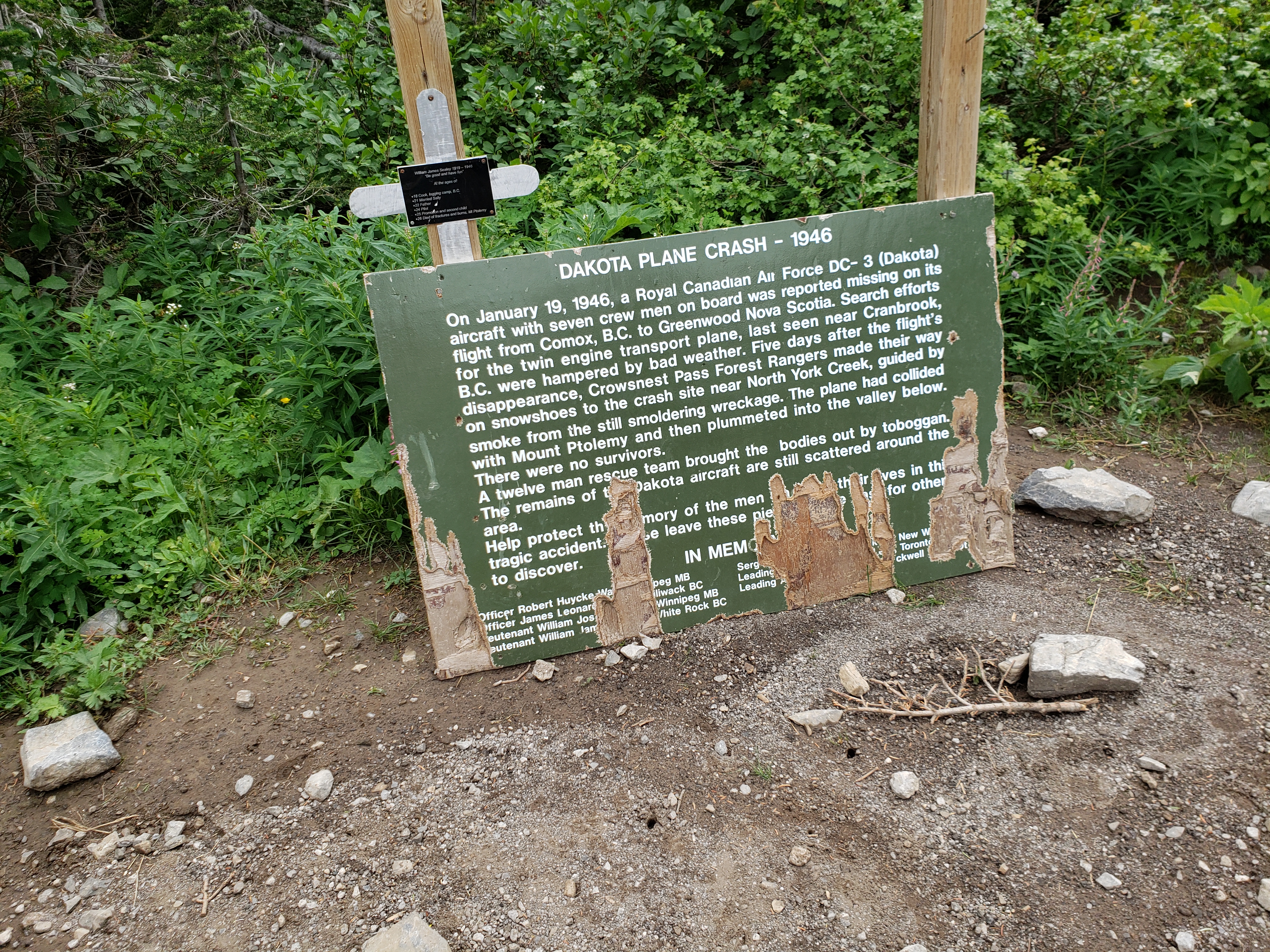
8/8/2020 3:56 PM 4631428 North York Creek, AB hike 20200808_155612 RCA DC-3 Dakota 1946 plane crash memorial.jpg
After munching on a few Clif, Builders, and other granola bars, we headed back down.
If I had thought to see the other side of that sign, I’d see “Public Land Use Zone Boundary”. I’d still have no idea which side was which.
I think Mo was so happy that we made it that he did a dance on the way down.
I was a little concerned we wouldn’t make it before nightfall. In the mountains, dusk happens considerably sooner than on the flat prairie. I hinted a few times that we should make our way back soon.
In a way, it was harder getting down than going up! The knees only handle so much of the jarring. Most of us slipped on rocks and landed on our butts at least once on the way down. Plus, it started to rain while we nearing the bottom. Not too much – just a little.
The V family had their phone cameras and a GoPro on a stick. Once they figured out if it was actually recording or not, they had fun making their action videos. I was impressed enough with a video they sent me that I bought one for myself. Not an actual GoPro brand but similar.
Finally we made it back to the van. After a long haul like this, it’s amusing how good a vehicle looks.
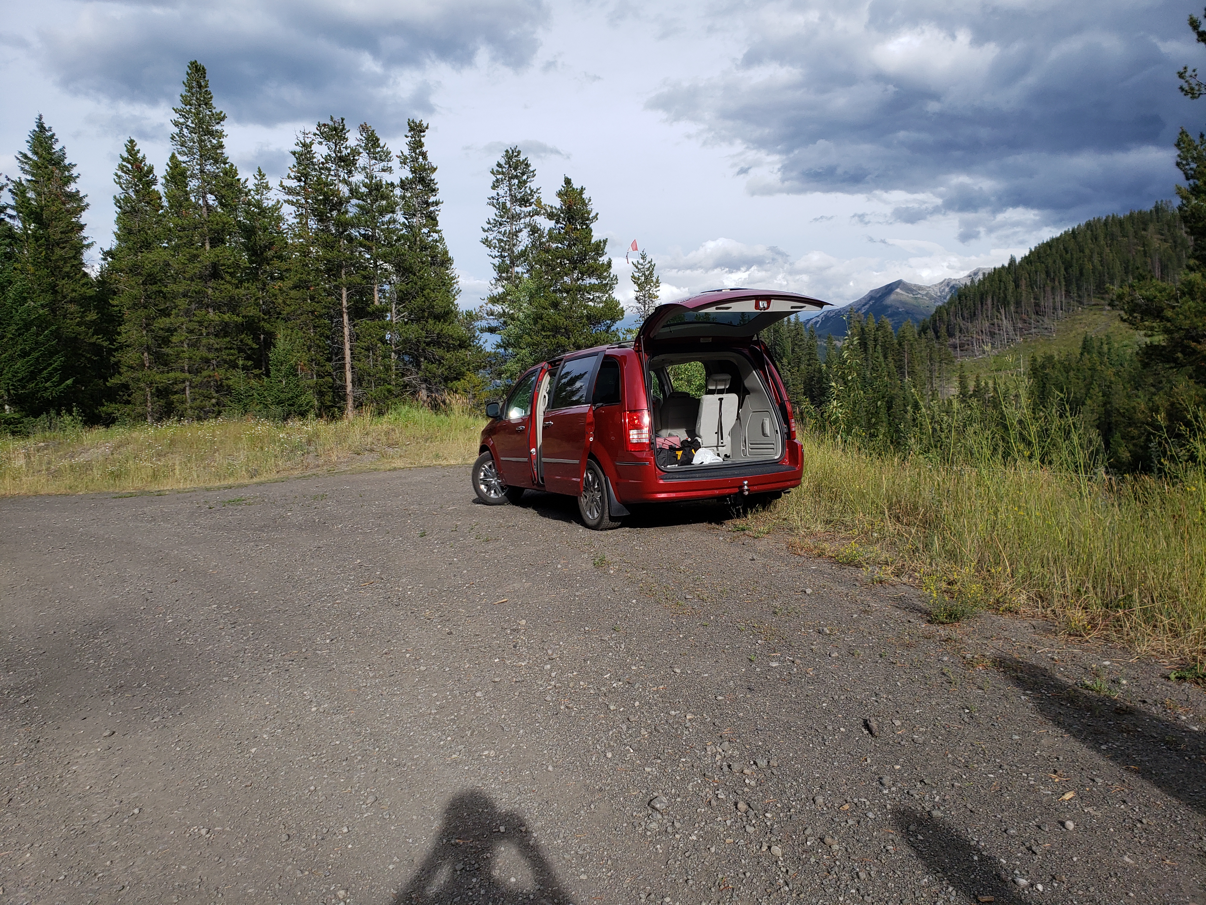
We sat in the van and ate. Very satisfying to sit and rest and eat and know what we hiked 20km in total and made it back alive.